Many factors go into long-range forecasting the winter season here in Central Ohio. Some factors include water temperatures as far away as the Pacific Ocean to the amount of snow in Siberia. Let's call it the science of the season, starting with what some call the "Refrigerator of the Northern Hemisphere."

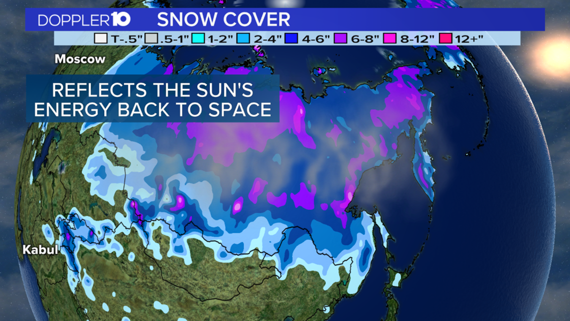
The amount of snow cover over Siberia this time of year can impact how harsh our winter will be in Central Ohio. As cold air over that region of the world allows snow cover to increase, the snow reflects more of the sun's energy back into space, making it ever colder. That cold air can eventually make its way to Ohio by the middle of the winter.

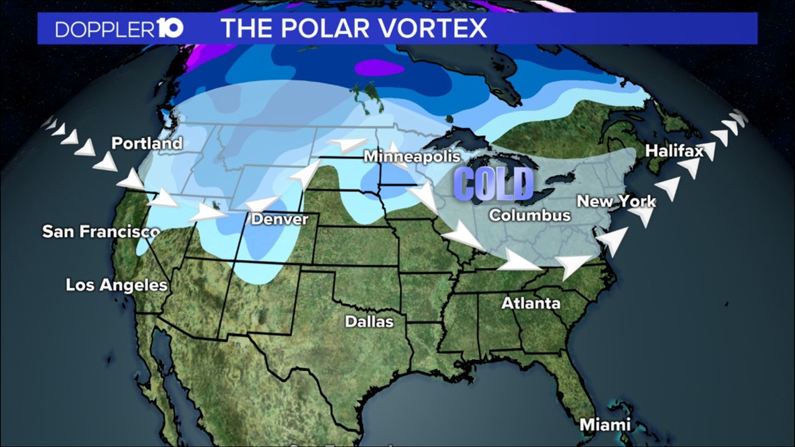
The more snow cover can also weaken the polar vortex which allows extreme arctic air to move into Central Ohio. And if we have moisture in place that's going to lead to more snow and ice.

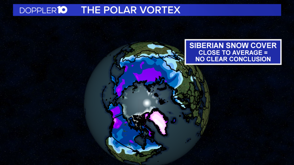
However, right now Siberian snow cover is fairly close to average which doesn't point to any clear conclusion.

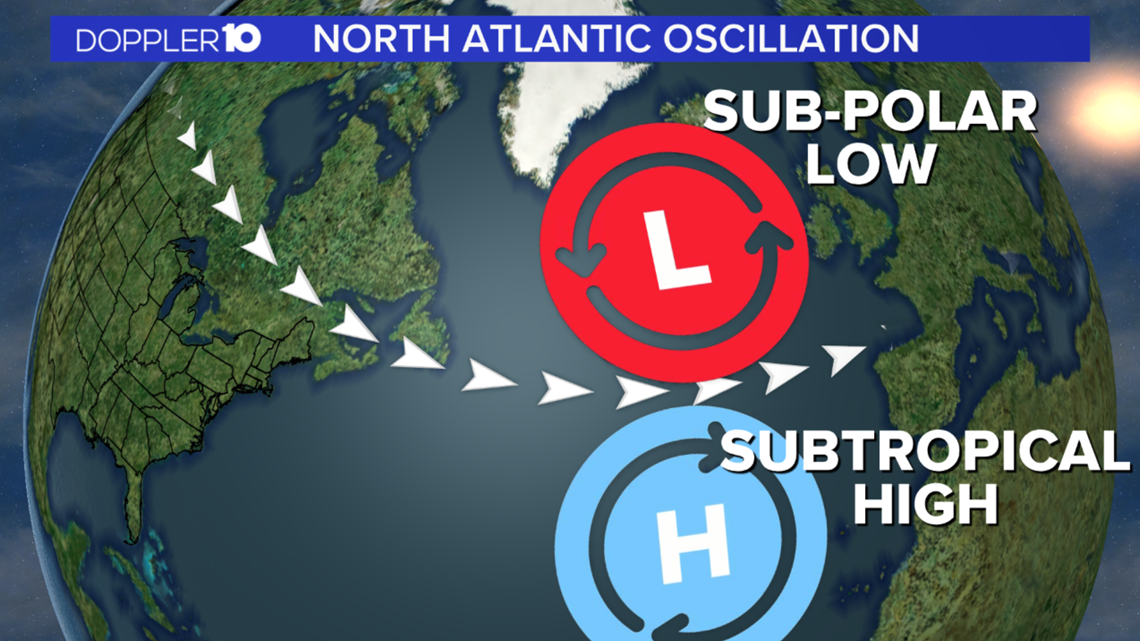
But there are other atmospheric factors to consider like the permanent area of low pressure that sits near Iceland and Greenland called the sub-polar low. Just to the south, an area of high pressure resides called the subtropical high. The placement, or pressure difference, between these systems is called the North Atlantic Oscillation and impacts the jet stream's position, which then has an impact on our winter weather.

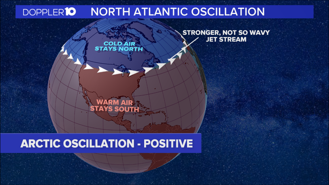
In a positive phase, the sub-polar low and the subtropical high are stronger than average keeping the jet stream from dipping south across parts of the U.S. bringing mild conditions and fewer storms.

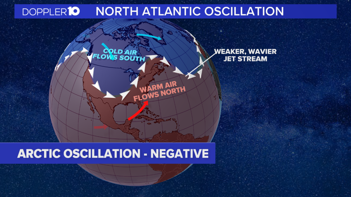
A negative phase is the opposite. Weaker pressure will allow for the jet stream to drop lower with arctic air. We normally see more winter storms with above average snowfall. But as for this winter, it's too early to tell.
From the Atlantic to the Indian and Pacific Ocean. There is a different weather disturbance along the tropics that starts in the Indian Ocean and progresses eastward across the globe, circling it every 30-60 days. The Madden Julian Oscillation (MJO) has two phases.

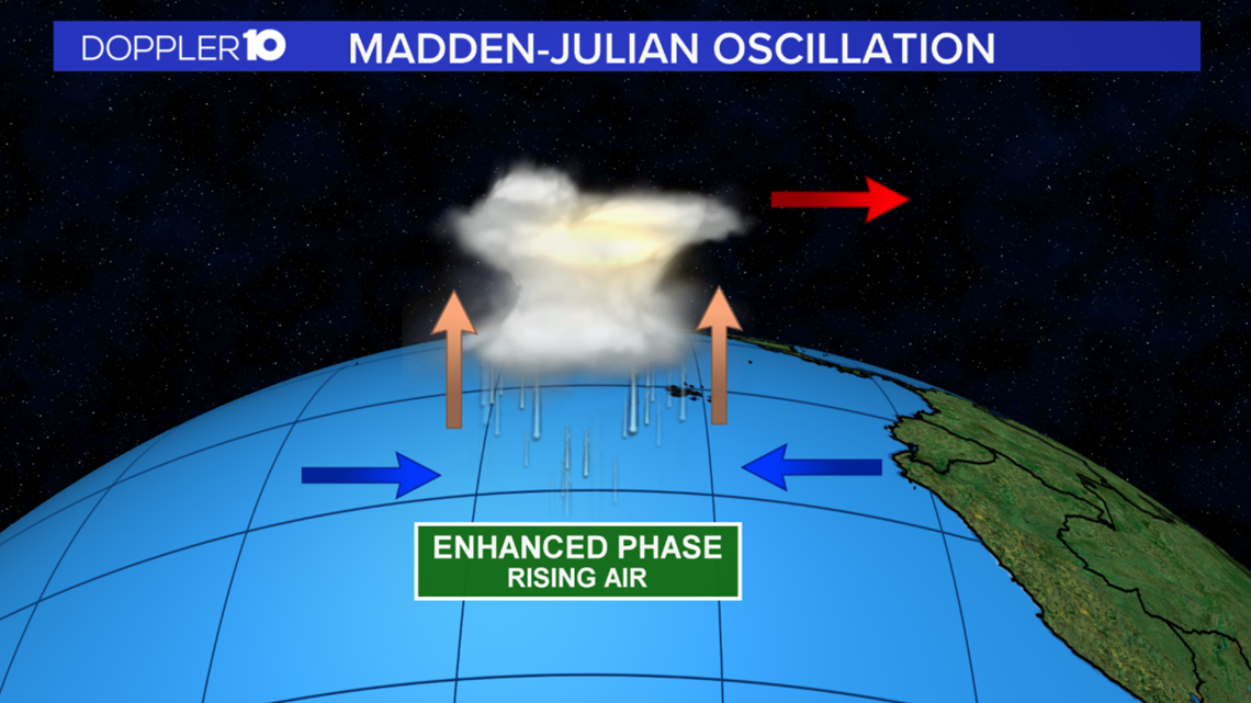
During enhanced phases there is rising air, which creates an area of convection or thunderstorms.

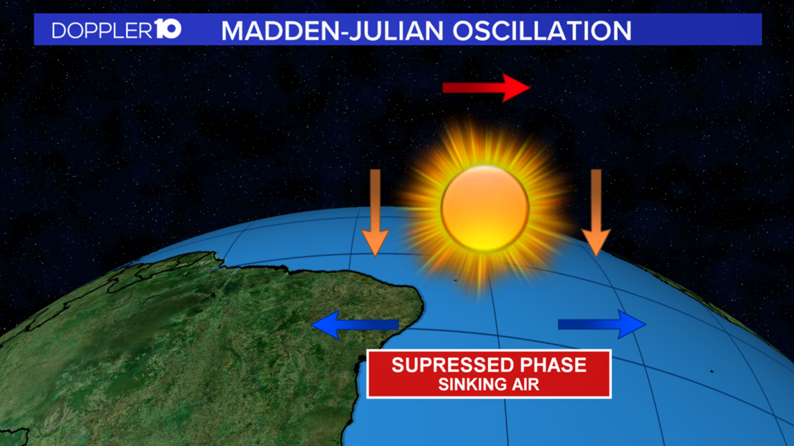
The suppressed phase is when the air is sinking causing the weather conditions to be sunny and dry.

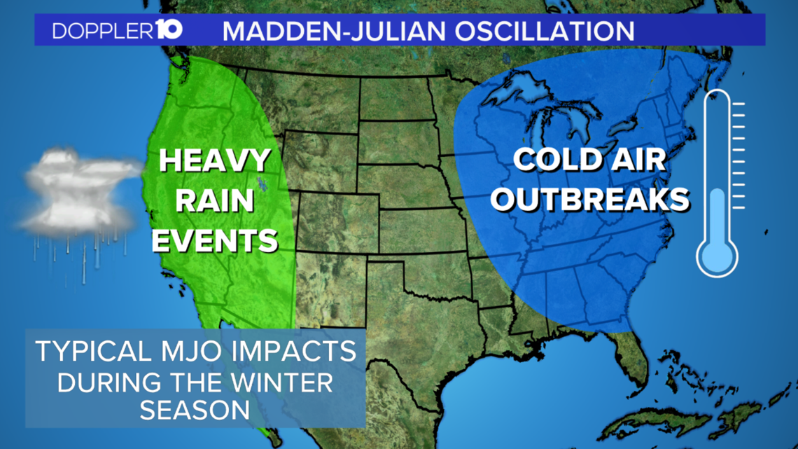
If a strong MJO were to develop, it can lead to greater precipitation on the west coast, and more frequent and intense outbreaks of cold air across the eastern U.S.
Mike Halpert from the Climate Prediction Center explains, “It will only then persist and give us a pattern for maybe a couple of weeks opposed to what we can sometimes see which is a far more persistent type winter pattern when dealing with El Nino or La Nina.”

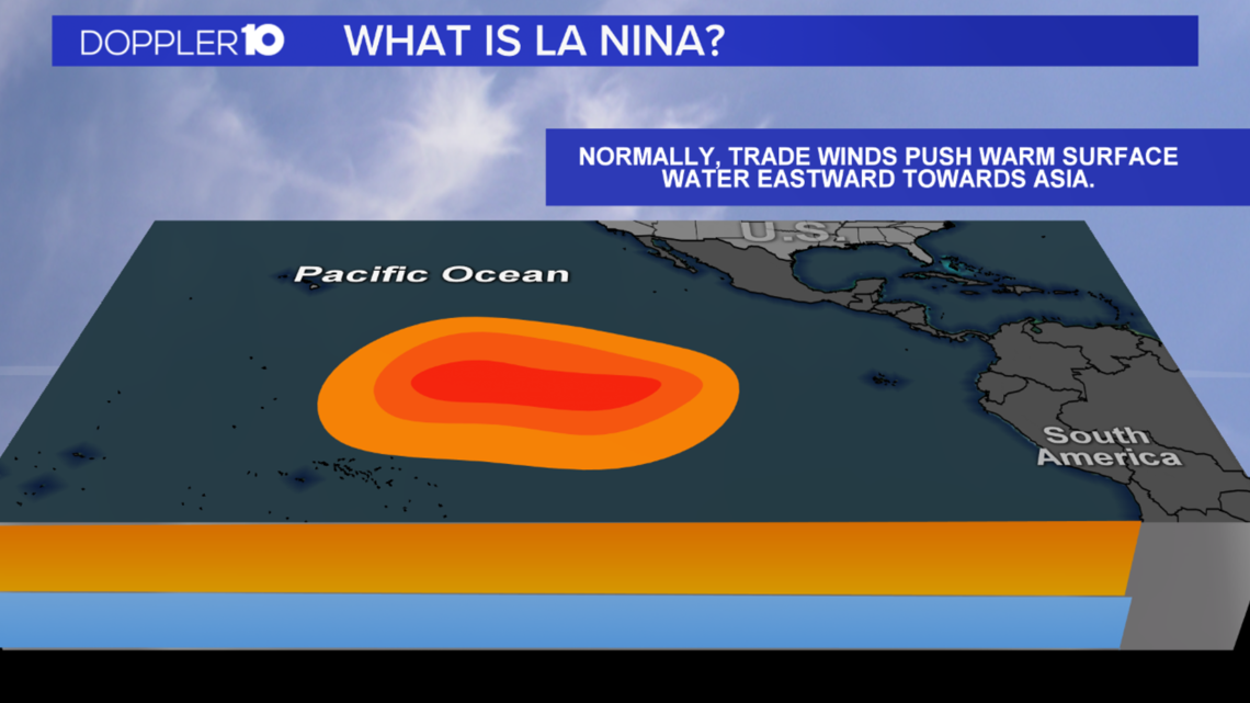
So let’s dive more into El Nino and La Nina. These weather patterns are all about the warm, tropical, surface water in the Pacific Ocean. Normally, trade winds push warm surface water eastward towards Asia.

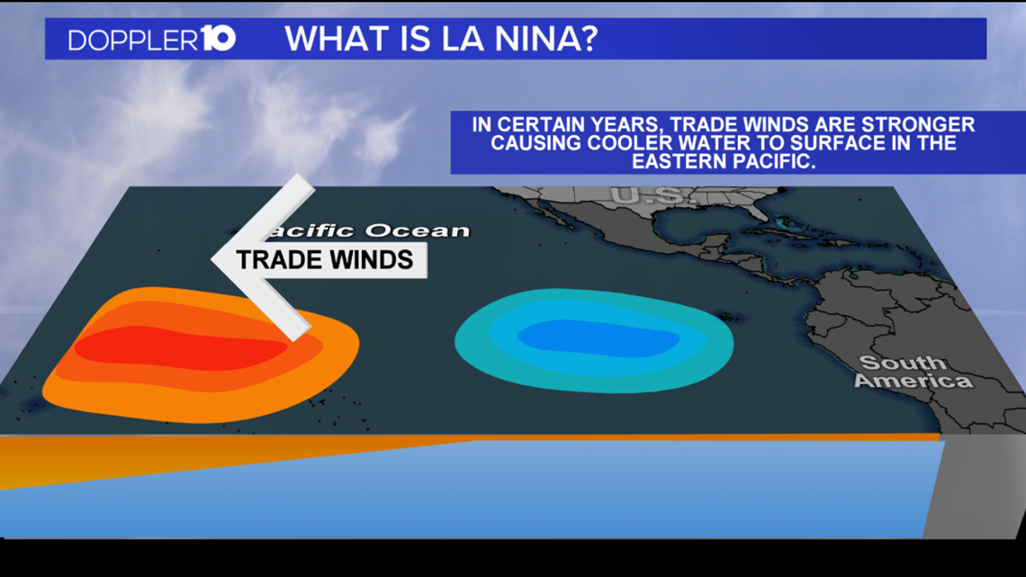
In certain years, trade winds are stronger causing cooler water to surface in the Eastern Pacific. During a La Nina winter, the warmer water that moves west has a huge impact on the jet stream.

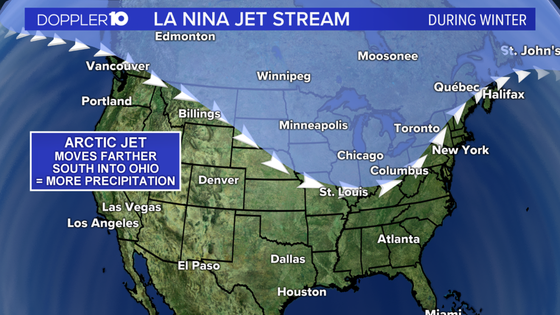
As a result, the arctic jet is father south – in fact as far south as Ohio. That means we would be on track for above average precipitation.

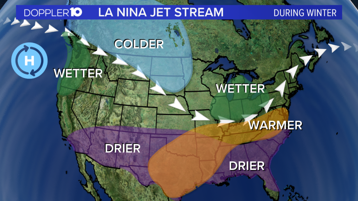
Although, It's hard to forecast whether that means it will be rain or snow because that's dictated by the temperatures.
"What determines the areas that see snow is the storm track, so if the storm is to the east of your location you're likely to be in the colder air and if the air is cold enough you will see snow. If the storm is to the west of your area then you're going to be in the warmer air and you're going to see rain. In a general sense, the storm track being that it is shifted to the north, often times Ohio ends up in the warmer air, so the warm side of the storm and again in a very general sense there's actually a slight tilt towards less snow in particular across the southern part of the state,” adds Halpert.
Even with all this science, there is still a lot of uncertainty, but the latest three-month outlook put out by the Climate Prediction Center that takes into account many factors has our temperatures above average and precipitation close to normal through this winter season.


