COLUMBUS, Ohio — The winter storm, projected to arrive in central Ohio Thursday night into Friday morning will bring dangerously cold temperatures, strong winds and blowing/drifting snow that will lead to poor driving conditions.
Thursday night expectations
Once this cold front moves through central Ohio Thursday night there will be a quick change over to snow around midnight. When that changeover happens, that will be the beginning of accumulating snow potential. Snow will then likely fall through the overnight and will taper off by daybreak. Winds will be picking up as the snow falls and tapers off, so technically, there will be at least three hours where snow will be falling and blowing across the area.
Friday morning expectations
Even after the snow tapers off, the snow will be light enough to blow around as winds pick up late Friday morning. With wind gusts in excess of 40-50 mph at times, while not much more additional snowfall will occur, there will likely be blowing snow into the evening hours.
Get your full forecast here.
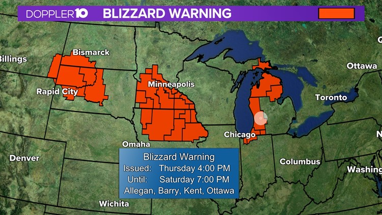
Alongside the concern for ice and strong winds brings the possibility of a blizzard. But, what kind of conditions qualify as a blizzard?
To be classified as a "blizzard warning," weather must meet the following conditions:
-Wind gusts of at least 35 mph and blowing snow
-Reduced visibility of <1/4 mile or less for at least three hours
-Does not account for snowfall amounts and warnings are independent of specific amounts just snow falling is needed
Our National Weather Service office hasn't issued a blizzard warning for central Ohio in 10 years.
The question is just how much of this snow gets blown around and how drastically visibility becomes reduced is still to be determined which is why you should avoid traveling on the roads as much as possible Friday morning and afternoon — especially if a blizzard warning is issued.


