We're almost a third of the way through January and a recent stretch of mild weather has had it feeling more like spring than the dead of winter.
The overall weather pattern has been seesawing from cold to warm and back for a few months now. November started out mild but then got cold before things warmed back up over the first few days of December only to get cold again. We rounded out the month with mild conditions that have persisted (for the most part) into the beginning of the year.
Even though the temperature has been up and down, one thing that has seemed constant is the precipitation... we've had over 9.5" of it since the beginning of November which is roughly a quarter of what we see in a given year.
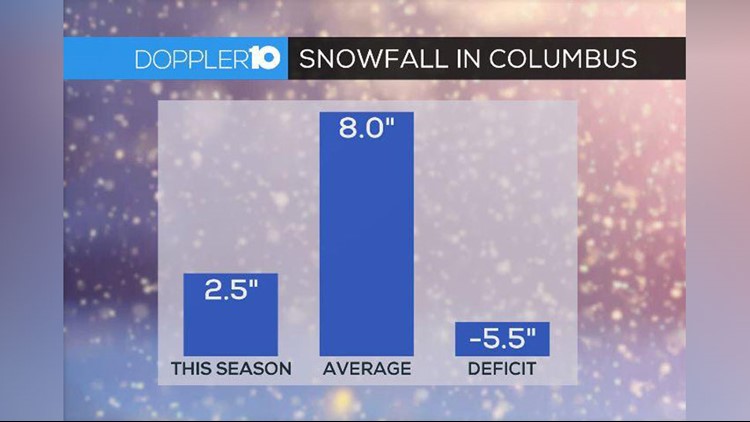
Even though we've had the moisture in place, it hasn't really coincided with cold air which is why we've only seen 2.5" of snow so far this season, which is a 5.5" deficit.

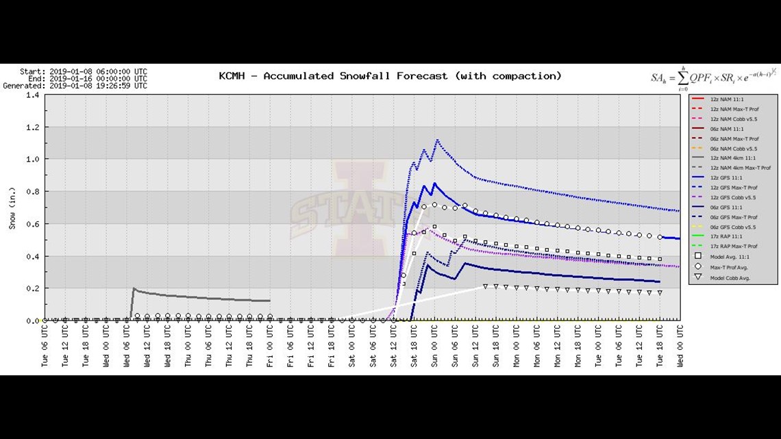
Right now, models are hinting at a little snow possible this weekend but it doesn't look like much.
Without getting too technical, the model above is calling for anywhere from just rain to possibly an inch or so of snow on Saturday. The model consensus is hinting at a half of an inch to maybe an inch but, keep in mind, it still looks like some rain will mix in with this and the totals are subject to change.
It'll bear watching but right now there isn't a whole lot of hope for a blockbuster snow event anytime in the immediate future.
Having said that, let's remember that it's not all that uncommon to have this little snowfall this far into the season. In fact, the last time our "snow drought" was this bad at this point was only a few years ago during the winter of 2015-2016 when we'd only seen a trace of snow through January 8. We ended up getting 17.1" of snow that season. That's still below average (we typically get 26.7" of snow each year) but it shows that we should by no means throw in the towel, or think we're in the clear; depending on your attitude towards snow in central Ohio.
There have been 30 winters that had 2.5" or less snowfall through December in the climate records (snow records date back to the winter of 1884-1885) which is about 22 percent of the time.

So how is the rest of the winter looking?
Well, it looks like more of the same... for now.
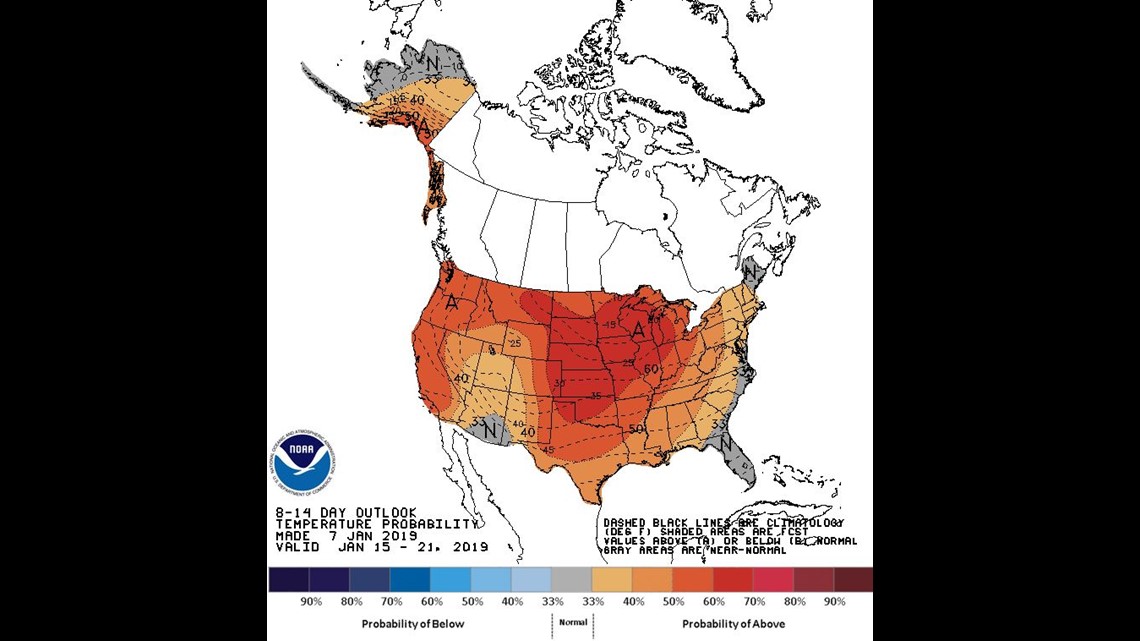
We have a cooldown that will affect the rest of the week and even the weekend. Beyond that, climatological factors are hinting at another upswing in temperatures sometime late next week with above average temperatures expected through about the third week of January.
Keep in mind average at that time is the mid to upper 30s so it doesn't have to get that warm for temperatures to be above average.

Beyond that, the last third of January is looking to then shift back to below average conditions.
If you're sensing a pattern, you're perceptive.
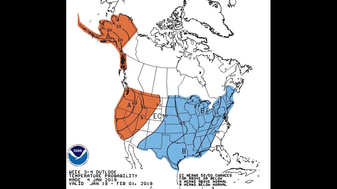
The swings in temperature are expected to continue but my gut is telling me the warms won't be as extreme. And then one long-term model is hinting at average to slightly below average temperatures in much of February.

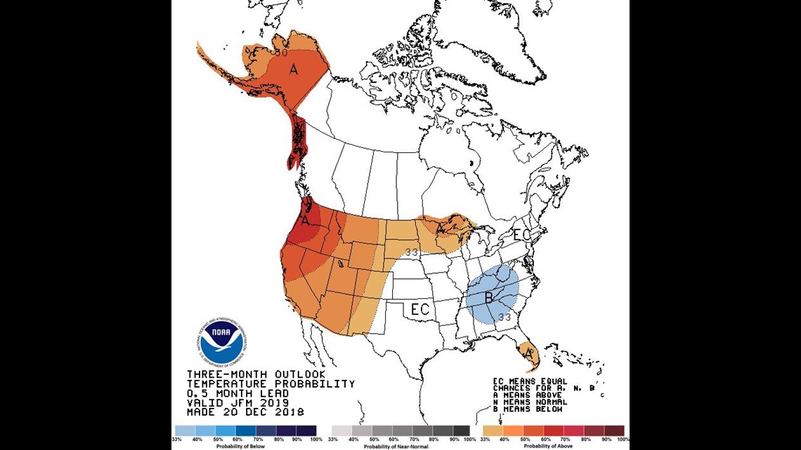
That seems to be in line with the latest Three-Month Outlook from the Climate Prediction Center (issued in late December).

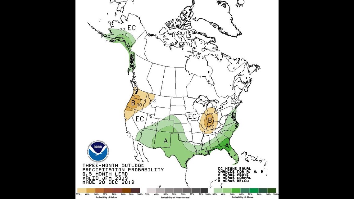
The latest Three-Month Outlook for precipitation is hinting at below average precipitation for January, February and March.
This would mean that even if we do start to see a more steady stream of cold air, there may not be a whole lot of moisture with which to play. I looked at a long-term snowfall model (it goes out about a month-and-a-half) that was only suggesting about a foot or so of snow through much of February. That would mean we'd be more likely to have below average seasonal snowfall.
Even if that is the case, I still wouldn't be surprised if we get at least a little snow in March. It seems like we always get something then, and usually after a tease of springlike weather.
Keep in mind there is still a lot of uncertainty that goes into long-term forecasting. I always say it's hard enough to forecast out a week in advance much less a few months.
Having said that, this is how things look with the data we have now. In weather forecasting, there's a saying, "The trend is your friend." And that's what we're looking for when peering into the crystal ball that's known as a long-term forecast.

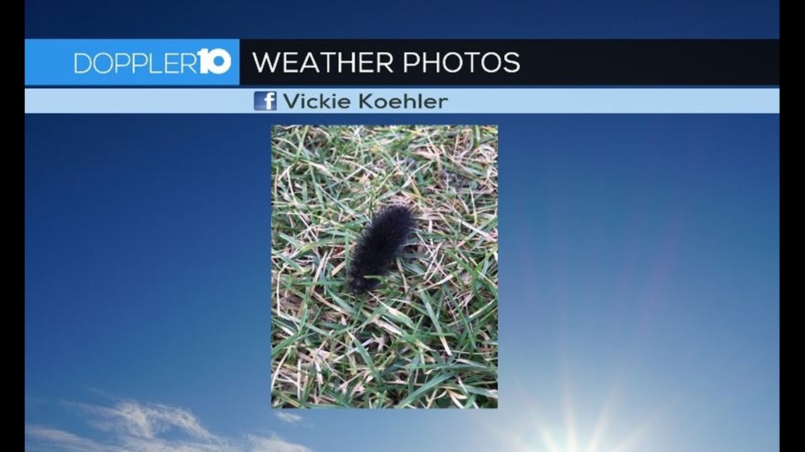
I'll leave you with this photo of a wooly worm that a viewer, Vickie found.
Legend has it that these guys can forecast the coming winter. Because this one doesn't have a brown band, it would suggest that a harsh winter is on the way.
We'll keep you posted on-air and online with any changes to the forecast in the coming days and weeks.