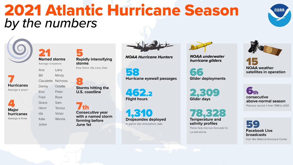
COLUMBUS, Ohio — The 2021 Atlantic Hurricane Season just concluded on Nov. 30 with 21 named storms, seven hurricanes, and four major hurricanes.
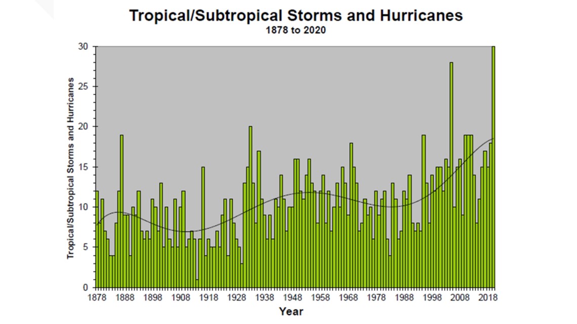
This year was awarded the third most active year on record and it was the first time that back-to-back hurricane seasons used the list of 21 storm names.


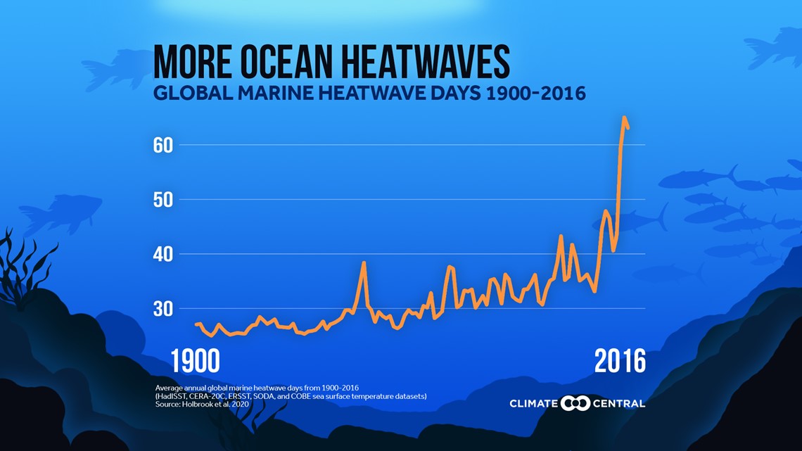
Matthew Rosencrans and other meteorologists at NOAA are studying the impacts that warmer ocean temperatures have on our tropical development.
"When you look over a longer period of time, 20, 30, 40 years, most of the ocean trends are warm on every point on the entire globe," Rosencrans said.
Seeing warmer water, along with a list of other ingredients needed to form hurricanes, could mean that we could see stronger and longer-lasting storms.
“There is an increased potential for more storms to reach Cat 4 and 5 once they become a hurricane. So they can get to more of those higher-end scales a little more frequently than we would in the past," Rosencrans said.


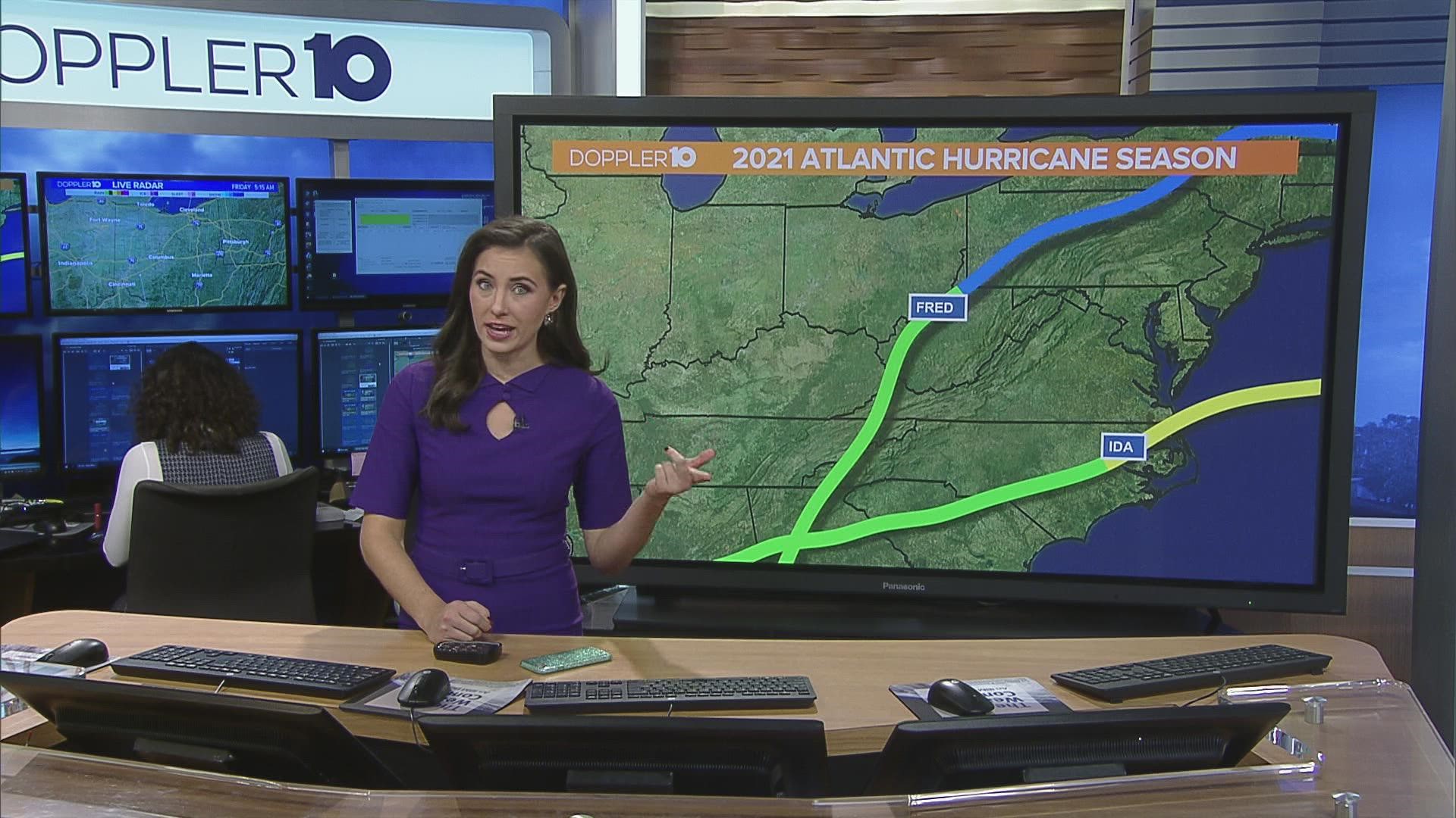
Ohio is no stranger to seeing the remnants of tropical systems. Just this past year, Hurricane Ida brought parts of Central Ohio 3-5 inches of rainfall in a day. So it’s possible that if our hurricane seasons become “more active”, it could have further impacts on the Midwest.
“There is more of a potential for a storm to hold together as it moves inland. So even if it makes landfall in the Gulf Coast, the amount of moisture it could bring up into Tennessee and up into the Ohio Valley could lead to inland rain and inland flooding," Rosencrans said.
If our climate continues to warm, coastal areas could see higher storm surge and frequent coastal flooding.


If you want more information on the 2021 Hurricane Season, click here. If you want more information on the National Hurricane Center and its forecasts, click here.

