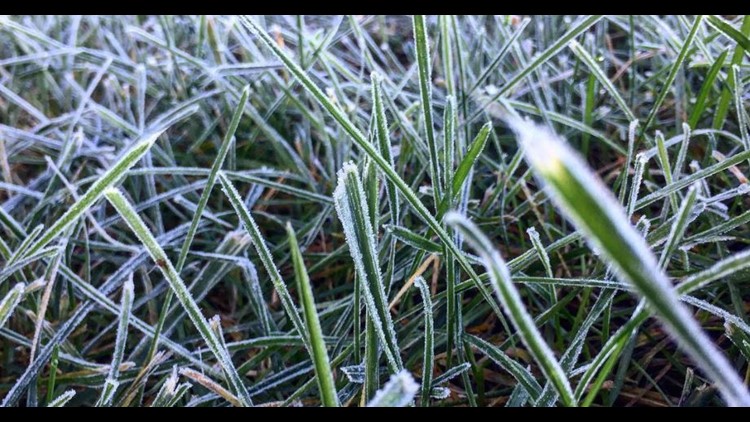
Hard to believe we went from a heatwave at the start of the month to now talking about some areas seeing their first frost later this weekend.
And yes, it is possible. While it's not a widespread frost event, there will be some patchy frost across the state as the coolest air of the season arrives over the weekend. This will be brought by a cold front that will bring widespread rain Saturday morning, with temperatures gradually declining throughout the day. We'll then clear out and cool down even more on Sunday.
Interestingly enough, according to the Farmer's Almanac, the average first frost in Columbus is October 13 and it looks like this Sunday, October 13th, will be when temperatures will drop into the 30's across a good portion of the state.
Below is a look at two long-range models that show low temperatures of 41(GFS) & 39(EURO) degrees Sunday morning.

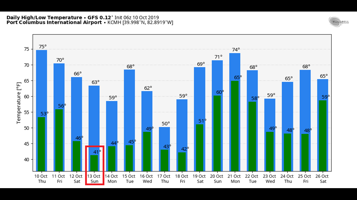

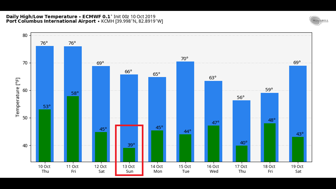
This is just a forecast for Columbus but other areas could be into the upper 30's across the state Sunday morning. And while it doesn't appear that temperatures will be around 32 degrees, frost will be possible even if Sunday's morning temperature is somewhere in the upper 30's.
There’s a difference in the numbers due to the fact that the temperatures are taken five feet above the ground. Because of that, the sensor may read 36 while it cools down to freezing at the surface where the winds are lighter and temps can drop a little further during favorable conditions. That also means when the temperature reads 32 it may actually be even cooler at the surface, etc.

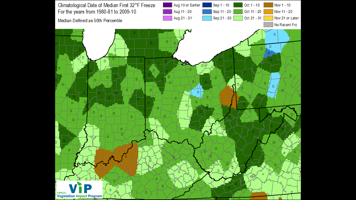
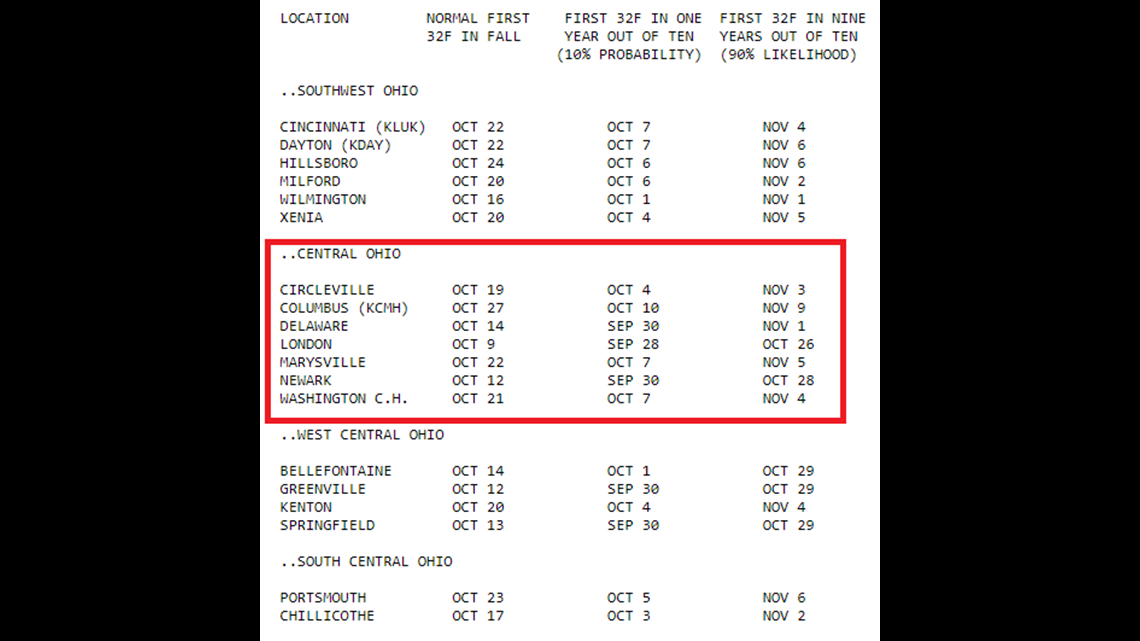
The average first freeze (32 degrees Fahrenheit or lower) in Columbus is October 27, per the NWS.
Below is a reference table provided by the NWS Wilmington Ohio office to give you an idea as to when the first freezing temperature might occur based on the latest climatological data at each listed location(1981-2010).

As we move through the season you may see Frost Advisories or Freeze Watches/Warnings. According to the NWS, The frost/freeze program will be ended on a county by county basis once a widespread freeze has occurred.
So what’s the difference between the different classifications?
A Frost Advisory is issued when the low is forecast to drop between 33 and 36 degrees on a clear and calm night during the growing season.
A Freeze Watch is issued when we have the potential for a widespread freeze within the next 24-36 hours. A Freeze Warning is issued when a widespread freeze is in the forecast. These are issued in autumn until the end of the growing season by the NWS. The growing season ends once the first widespread freeze hits.
You may also be familiar with the term “Hard Freeze”. This occurs when temperatures drop to 28 or below which is enough to kill most vegetation. While there’s no temporal requirement to make it a hard freeze in this area it usually means we hit 28 or below for three to four hours.

In the next couple days, we'll be able to more accurately see how temperatures across the state will change into this weekend. In the meantime, it might be a good idea to be prepared to cover up your plants Saturday night as temperatures begin to tumble.
If you have any questions about frost/freeze climatology or winter weather, please email me at ross.caruso@10tv.com