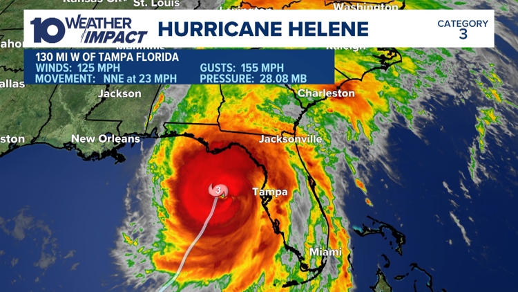
COLUMBUS, Ohio — Hurricane Helene has weakened to a tropical storm with maximum sustained winds of 75 mph.
The National Hurricane Center says the storm has traveled north from Florida to Georgia and was about 100 miles from Augusta and 40 miles from Macon moving at about 30 mph at 4 a.m.
The center says Helene came ashore Thursday evening in the Big Bend area of Florida’s Gulf Coast. Officials have forecast storm surges of up to 20 feet and warned they could be particularly “catastrophic and unsurvivable” in Florida’s Apalachee Bay.
Hurricane warnings and flash flood warnings extend far beyond the coast up into northern Georgia and western North Carolina. At least three deaths have been reported.
AEP Ohio said 120 field personnel will travel to North Carolina to stage until the storm moves through the area. Once it passes, the crews will head to areas where they are needed. Ohio Task Force 1 also announced that its crews are mobilizing to assist with relief efforts.
Interactive Helene radar
Central Ohio weather impacts
Gusty winds and heavy rains are expected in Ohio by Friday, prompting the declaration of a Weather Impact Day for the region.
The combination of gusty winds and heavy rainfall is something we have not seen in central Ohio for several months. This combination will make for tough travel and outdoor events on Friday.
Forecast models show light rain early on Friday morning, then transitioning to heavy rain by Friday afternoon/evening. Models have been consistent at showing 0.50-1.25” of rain in the I-270 loop, with higher amounts across our southern counties. People who live in the northern half of the viewing area will see less rain.
Perhaps the biggest nuisance will be the strong winds. Gusts may exceed 40 mph at times on Friday, which will make travel difficult.
There may be some localized ponding on roadways for any storm drains that are not properly cleared.
We will continue to track leftover showers through Saturday and Sunday, however, the winds will be much weaker.


