
COLUMBUS, Ohio — It's that time of the year! The nights are getting longer, the evenings cooler and before long our first freezing morning commute will be upon us.
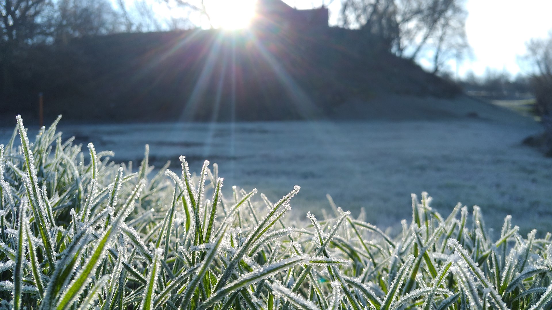
Before we get there though, frost will start to become a more frequent concern around central Ohio, and that started early Friday morning with a Frost Advisory in place around the 10TV viewing area.
A Frost Advisory is issued when frost conditions are possible during the season where plants are still growing outdoors and steps need to be taken to protect sensitive areas of vegetation.
This alert may have left some people scratching their heads and wondering how we can get frost when temperatures overnight are not forecast to fall to freezing? That's a valid question, and one that has an answer that is part science and part factor of how we measure temperatures for official records.
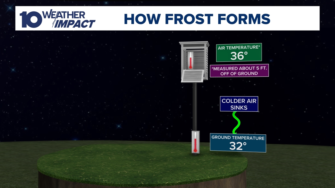
First, you should know that official temperatures are taken in a very specific way that differs from what you may do at home or in your car. Temperatures are officially measured from inside a covered shelter that is approximately 5 feet above ground level.
This means air mixed with light winds at this level can actually be warmer than where it pools against plants and the grass at the surface.

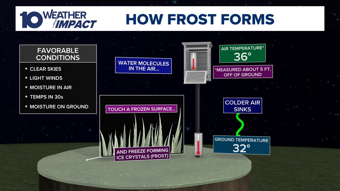
On nights where the sky is clear, winds are light, and temperatures will fall to near the dew point, frost will become likely as this colder air pools near the surface and condenses moisture onto leaves and surfaces that are now at or below the freezing point. This can happen even if the air above remains warmer.
Generally frost will become a possibility on these calm and cool nights when air temps are forecast to fall near to below 36 degrees.

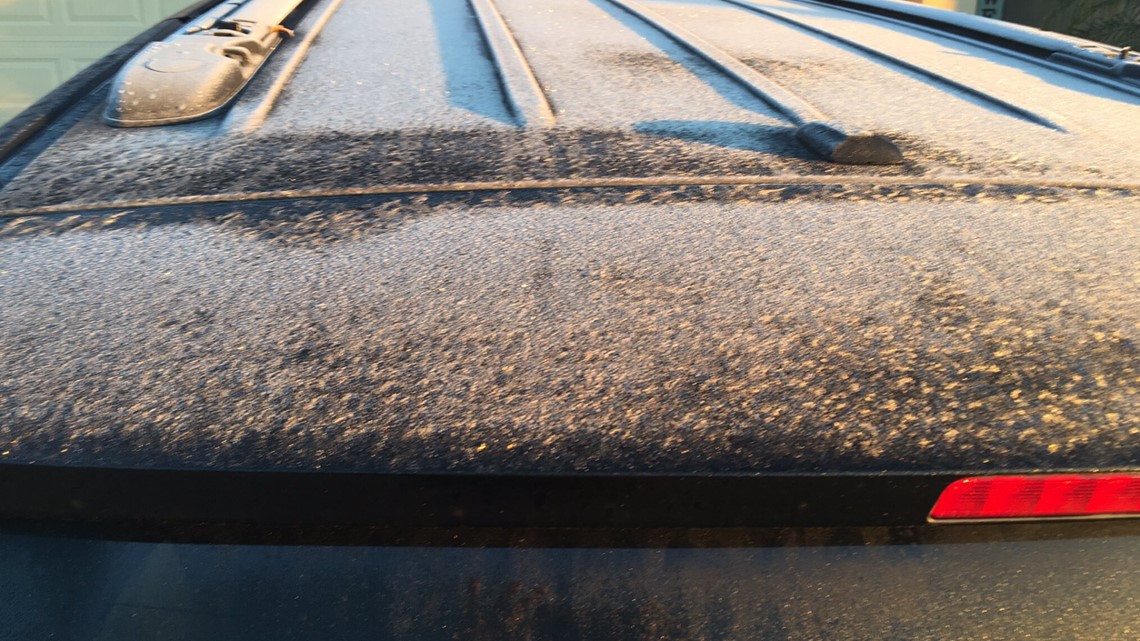
As for surfaces above the ground level that see frost form, think cars, roofs, and etc., it's mostly a factor of surface cooling. The air right up against the surface is where it is most likely to fall below freezing, be that on the ground or on your car. The warmth from these surfaces radiates up into the air at night as they are good conductors of thermal energy.
The air, by comparison, is not a good conductor of energy. The heat released from all the various surfaces in an area mixes together with any light wind and can cause temperatures to warm several degrees as you move a few feet above the plane that frost is forming on.

Of course, eventually even the air must succumb to freezing temperatures, and here in Ohio those days aren't far off.
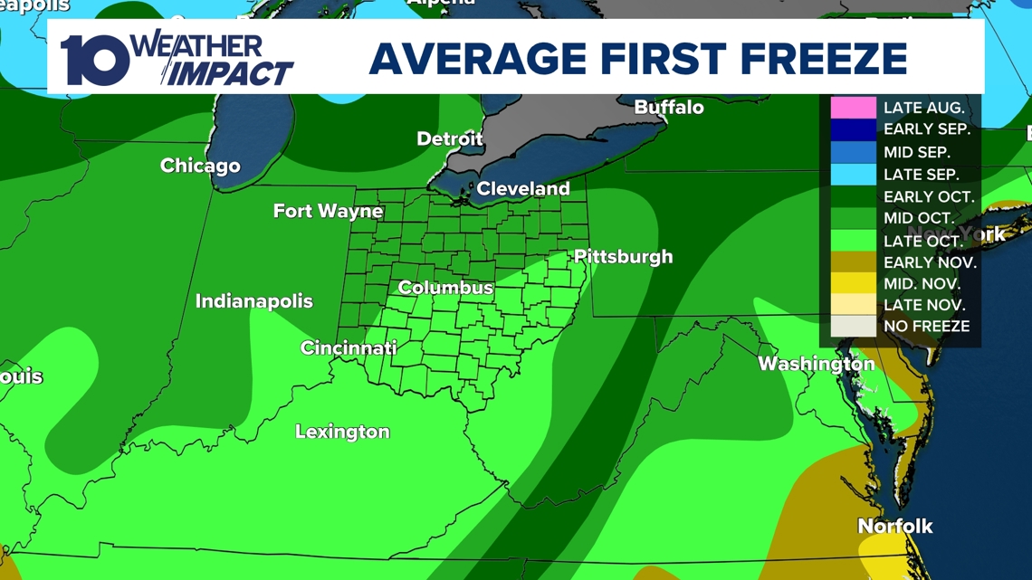
We usually see our first freezing temps by mid to late October!

Stay warm out there central Ohio!
-- Meteorologist Michael Behrens
Follow me on social media! Facebook Meteorologist Michael Behrens, X/Twitter @MikeBehrensWX, and Instagram/Threads @MikeBehrensWX.
Email me at: MBehrens@10tv.com