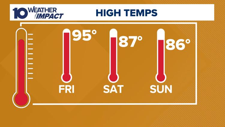
COLUMBUS, Ohio — Two days of heat advisories around central Ohio are behind us, but the scorching temperatures aren't quite done yet.
Temperatures will drop slightly on Thursday with the chance of clouds and isolated showers, but highs are still expected to be in the mid-90s.
We saw heat index values at or above 100 earlier this week, and it doesn't look too different until we reach the weekend.
The times of highest concern are during the afternoon and early evening when high levels of heat and humidity will make it hard to stay cool.

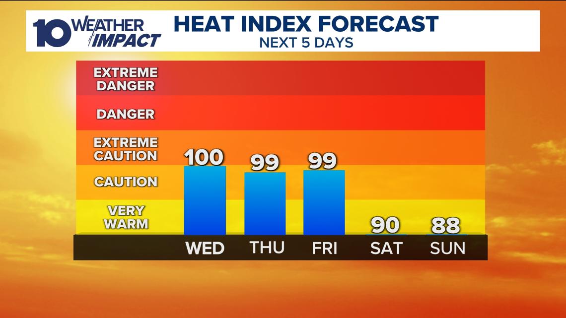
The heat and humidity combination will make it hard for your body to cool down by sweating so make sure you are taking precautions.
Take breaks inside when you can, ideally, 15 minutes inside for every hour of strenuous activity you do outside. If you can, do any strenuous tasks earlier in the day or late in the evening.
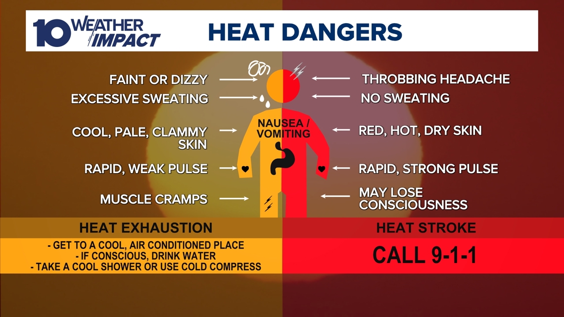
Make sure you are hydrating before, during and after any outdoor activities. Make sure you know the signs and symptoms of heat-related illness.
Make sure you are watching for signs of heat exhaustion or heat stroke both in yourself and those around you. A helpful guide to this is listed below.

While humidity will remain high through the end of the week, we're expecting a better chance of showers & a few thunderstorms on Friday. This should keep the most dangerous heat out of our region.
Stick with 10TV and the 10 Weather Impact team for the latest on this round of excessive heat as we head into next week.
---
Heat Watch vs. Heat Warning
*Info provided by the National Weather Service
Excessive Heat Warning
An Excessive Heat Warning is issued within 12 hours of the onset of extremely dangerous heat conditions. The general rule of thumb for this Warning is when the maximum heat index temperature is expected to be 105° or higher for at least 2 days and nighttime air temperatures will not drop below 75°; however, these criteria vary across the country, especially for areas not used to extreme heat conditions. If you don't take precautions immediately when conditions are extreme, you may become seriously ill or even die.
Excessive Heat Watch
Heat watches are issued when conditions are favorable for an excessive heat event in the next 24 to 72 hours. A Watch is used when the risk of a heat wave has increased but its occurrence and timing are still uncertain.
Heat Advisory
A Heat Advisory is issued within 12 hours of the onset of extremely dangerous heat conditions. The general rule of thumb for this Advisory is when the maximum heat index temperature is expected to be 100° or higher for at least 2 days, and nighttime air temperatures will not drop below 75°; however, these criteria vary across the country, especially for areas that are not used to dangerous heat conditions. Take precautions to avoid heat illness. If you don't take precautions, you may become seriously ill or even die.
Doppler 10 Weather Resources
___