Tropical Storm Isaias is garnering attention for its potential landfall on the United States coast this weekend, but it smacked another U.S. area first. On Thursday morning, Isaias dumped flood-inducing rain and drove heavy winds into Puerto Rico, leaving hundreds of thousands without power.
According to the island's Electric Power Authority, more than 300,000 customers woke up in the dark as electricity was knocked out across much of the island. Maximum sustained winds as strong as 60 mph were recorded as trees were toppled, roofs were damaged and frightening memories from Hurricane Maria were stirred up.
Adding to the Puerto Ricans' fears is that many of those roofs were never fully repaired after Maria, with blue tarps serving as an ominous reminder of what was devastated in the past and what continues to be threatened on Thursday.
In its 11 a.m. advisory, the National Weather Service office of Puerto Rico warned that the flood threats and strong winds presented a life-threatening situation for Puerto Ricans.
José Pagán told The Associated Press that he didn't expect the impacts to be as severe as they were, but he experienced some flooding in his home and a loss of power.
"I didn't think it was going to be this strong," he told the AP. "It's a rather difficult experience because it reminds us of Maria."
Photos and video circulated on social media throughout Thursday morning of roadways completely washed over and floodwaters reaching buildings.


In Trujillo Alto, about 15 miles southwest of the capital city of San Juan, three gates on the Carraízo reservoir dam were opened in order to relieve the excess runoff from the storm.
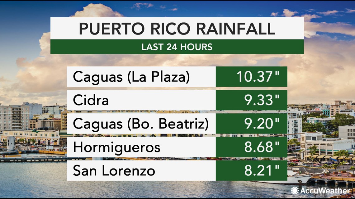
A total of 10.36 inches of rain was recorded in La Plaza, Caguas, while four other rain gauges recorded upwards of 9 inches. In the Dominican Republic and Haiti, the NWS said up 10 inches of rain could fall before the storm moves out.


The heavy rain not only caused flash floods but also triggered small landslides. Footage of one such landslide was captured in Limon, Mayaguez, located on the western half of the territory.
"Isaias was moving over the island of Hispaniola with maximum sustained winds of 60 mph during Thursday midday and was racing northwestward at 20 mph," AccuWeather Senior Meteorologist Alex Sosnowski said. "The tropical storm was less than 50 miles away from Punta Cana, Dominican Republic."
Heavy rains from Isaias were impacting the Dominican Republic on Thursday, and forecasters said it made landfall there on Thursday afternoon.
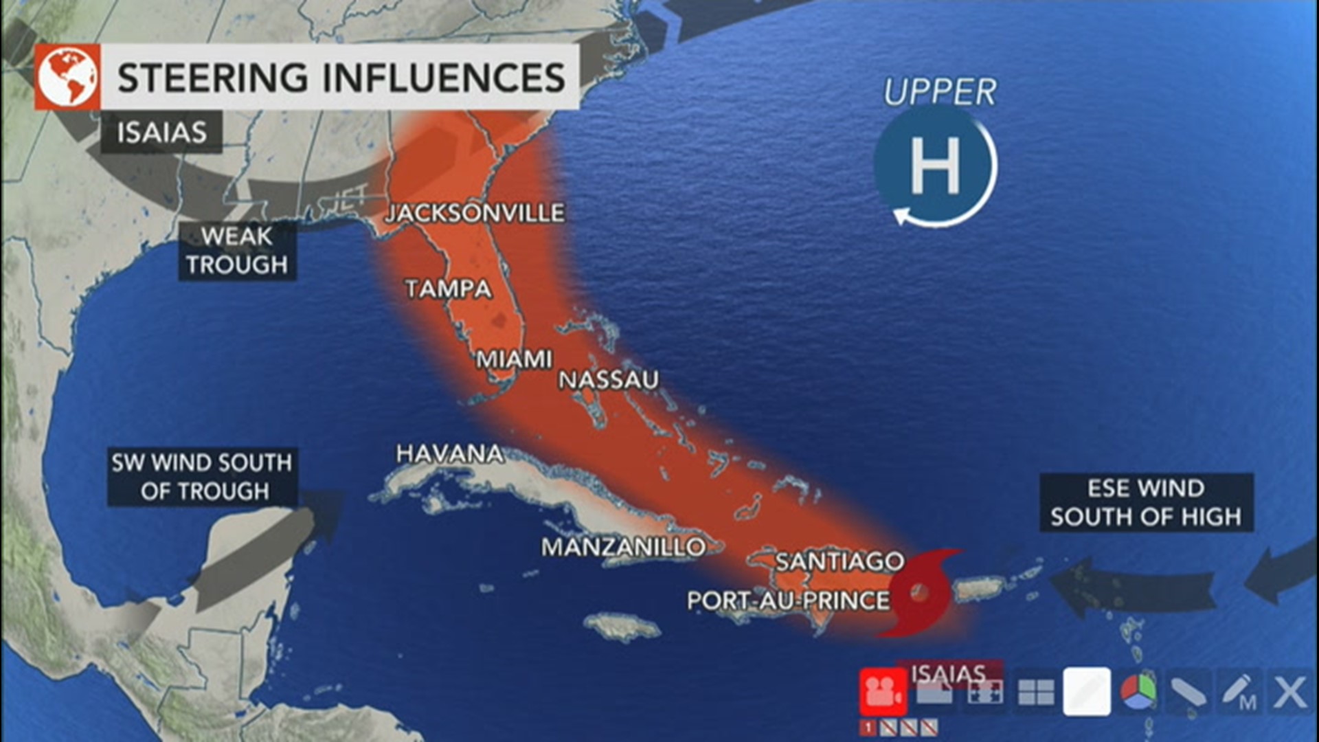
Land interaction with Hispaniola, the island shared by Haiti and the Dominican Republic, could weaken Isaias. Depending on the amount of weakening the storm undergoes, there are two primary tracks it might take as it swirls toward the U.S.
AccuWeather chief broadcast meteorologist Bernie Rayno boiled it down to a "fork in the road" for Isaias. If the storm stays over Hispaniola and suffers more weakening from encountering the mountainous terrain, Rayno said, the storm is likely to take a more southern track on which it will dramatically weaken as it passes over Cuba.
However, if the storm emerges on the northern side of Hispaniola and its center of circulation is able to re-form, "Then it's going to maintain its strength," Rayno said, adding, "Do remember, though, as it tracks toward the Turks and Caicos in the southern and middle Bahamas, there is dry air and [wind shear]. So that will limit its ability to strengthen."
But that track, Rayno cautioned, is likely to increase the possibility of a landfalling tropical storm on the coast of Florida.

