Another Atlantic basin record fell Thursday night as Tropical Storm Hanna formed over the warm waters of the Gulf of Mexico. Packing 40 mph winds and moving west at a speed of 7 mph, Hanna is on a crash course with the Texas Gulf Coast, threatening impacts as early as Friday.
Tropical storm watches and warnings were in effect Thursday afternoon across a large portion of the Texas Gulf Coast. As for when and where Hanna could come ashore, AccuWeather Senior Meteorologist Alex Sosnowski said, "We expect the system to make landfall as a solid tropical storm along the central Texas coast some time during the day on Saturday."
Even before the storm became a depression, Texas Gov. Greg Abbott on Wednesday urged urged "Texans to remain vigilant and closely monitor weather conditions" heading into the weekend. In a statement, Abbott said he was "preparing state resources to assist communities with potential flooding and heavy rainfall."
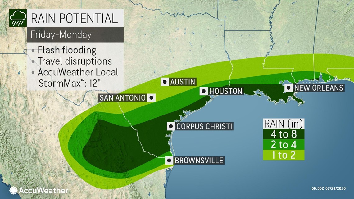
Heavy rain will be the primary impact residents along the Gulf coast will contend with, forecasters say. A general 2-4 inches of rain is forecast to fall across a wide area of southeast Texas and southern Louisiana. Places closer to the coast, including Corpus Christi, Galveston and even into portions of the Rio Grande Valley could see between 4 and 8 inches of rainfall. An AccuWeather Local StormMax™ of 12 inches is anticipated.
Locally heavy rainfall, enough to produce some flash flooding, will occur across parts of Louisiana and Texas Friday and Saturday, regardless of precisely where the storm comes ashore. "Some of the rain will be beneficial," Sosnowski said, adding, "but too much rain may also fall -- perhaps close to a foot in some areas -- which will lead to flooding."

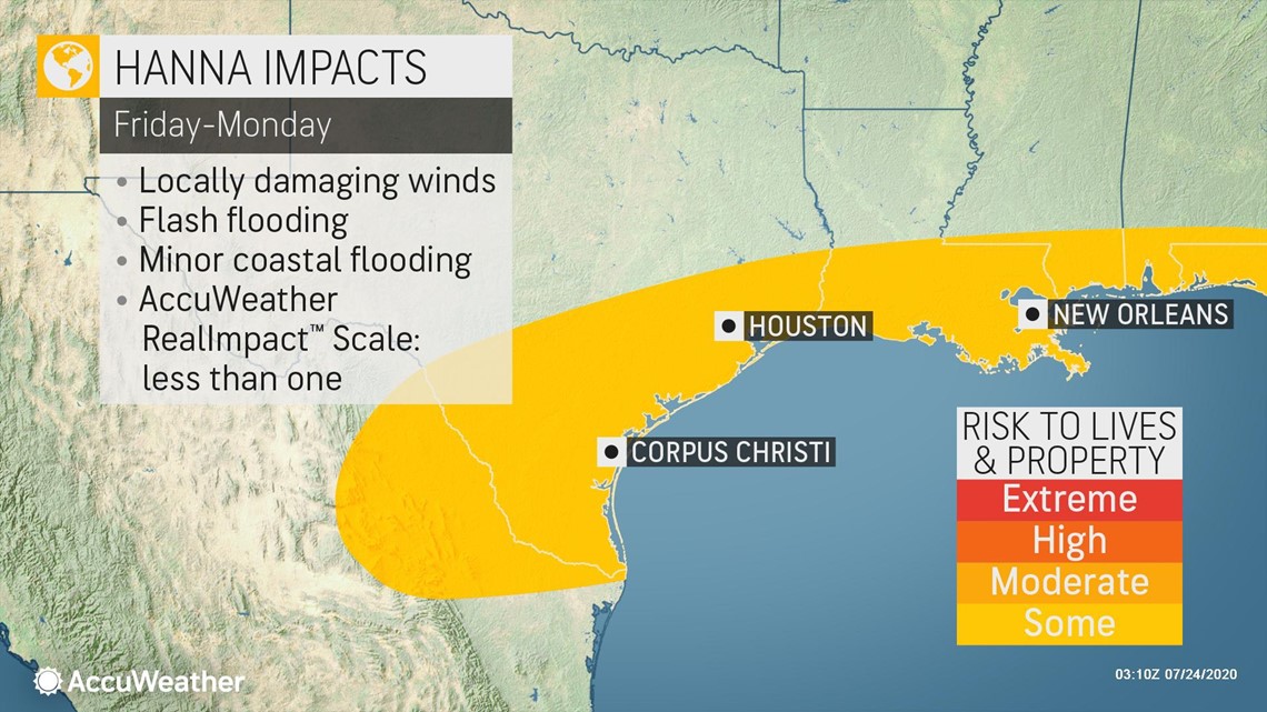
Gusty onshore winds could also lead to rough surf and rip currents along the central and western Gulf Coast into the weekend.

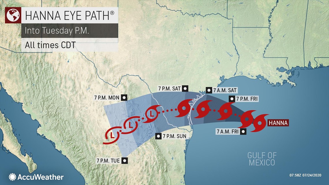
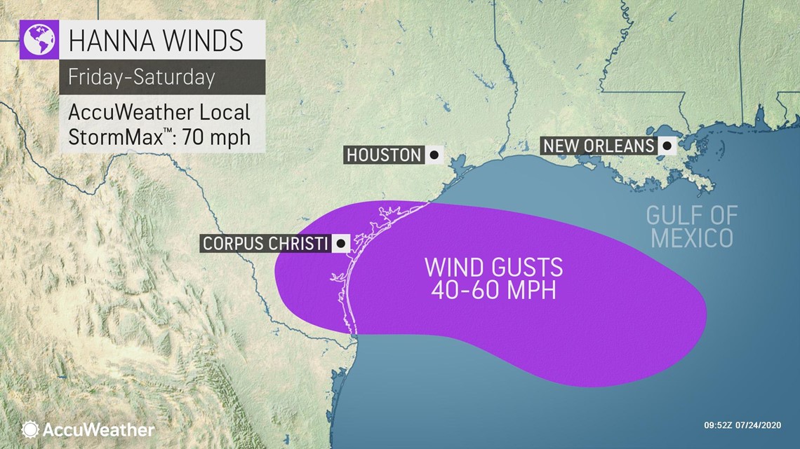
The greatest risk of tropical-storm-force winds between 40 mph and 60 mph will exist along an area from Galveston to Corpus Christi. There is the potential for the system to ramp up quickly just offshore of Texas, after it takes hold over the western part of the Gulf of Mexico. Water temperatures along the Texas coast are well into the 80s F, an essential ingredient for rapid tropical system strengthening.
"How much impact from wind will depend on the strength of the system as it moves ashore in Texas," Sosnowski said.

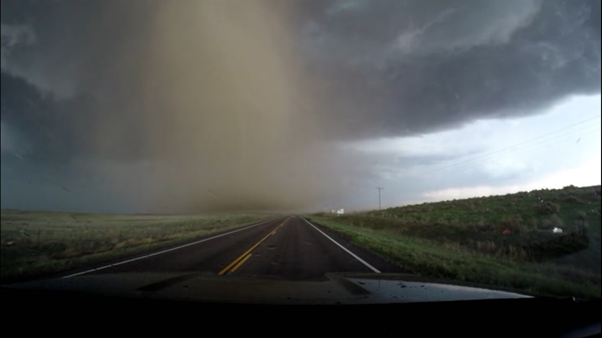
"There can be some gusty thunderstorms and perhaps a couple of tornadoes or waterspouts around the time of landfall at the close of the week," Sosnowski added.
An uptick in rough surf including the frequency and strength of rip currents is in store along the western and central Gulf Coast of the United States.
Overall impact from the system is projected to be less than one on the AccuWeather RealImpact™ Scale for Hurricanes. The greatest impact will be from rainfall and the risk of flooding.
Hanna is the latest named storm in what has already been a remarkably busy Atlantic hurricane season, and one that AccuWeather meteorologists have been warning for months would be "very active."

With its formation, Hanna earned the distinction of being the earliest-recorded "H" named storm in Atlantic basin history. Prior to Hanna, the earliest eighth-named storm was Tropical Storm Harvey from 2005, which formed on Aug. 3. The name Harvey was retired after Hurricane Harvey devastated the Houston area with more than 60 inches of rain in 2017.
Meanwhile, a strengthening Tropical Storm Gonzalo, a record-breaker in its own right on Wednesday, was churning in the central Atlantic Ocean, and threatening to become the season's first Atlantic basin hurricane.
Tropical Storm Gonzalo became the earliest "G" named storm. Three tropical storms that proceeded Gonzalo -- Cristobal, Edouard and Fay -- had also been the earliest storms of their respective letters. Gonzalo is forecast to become the Atlantic's first hurricane of the 2020 season this week.
And over in the Pacific basin, Hurricane Douglas, the Western Hemisphere's first hurricane of 2020, had exploded to Category 4 strength by Thursday night and was packing 130-mph sustained winds as it charged toward the Hawaiian Islands. AccuWeather meteorologists expect Douglas to weaken considerably before impacting Hawaii. But, the storm added to what is a stunning satellite image showing just how busy the tropics were during the third week of July. Douglas, Gonzalo and Hanna were all visible in one shot from NOAA's GOES-EAST satellite.
To stay up to date on the busy hurricane season, visit the AccuWeather hurricane center for all tropical weather information and news, including the next names on the 2020 Atlantic list.

