

AccuWeather meteorologists are putting parts of Central America, Mexico and the United States on alert for potential impacts following the development of Tropical Depression 14 in the Caribbean Sea on Thursday.
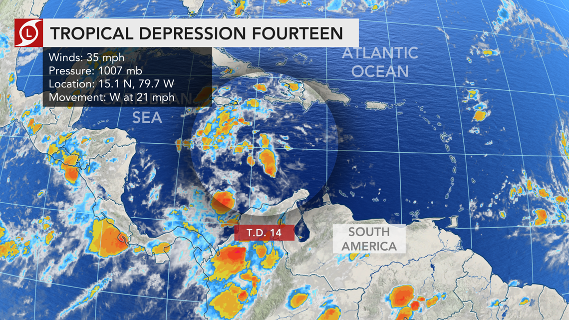
The National Hurricane Center (NHC) upgraded a tropical low situated over the central Caribbean Sea to Tropical Depression 14 shortly before 11 a.m. EDT Thursday. The system was located south of Jamaica and 235 miles east of the Honduras - Nicaragua border, with maximum sustained winds of 35 mph as it raced westward at 21 mph.
A tropical storm watch is in effect along part of the Honduras coast and for the country's Bay Islands.

"This system is becoming much more organized and is in an environment very favorable for additional strengthening," said Lead Tropical Forecaster and Senior Meteorologist Dan Kottlowski.
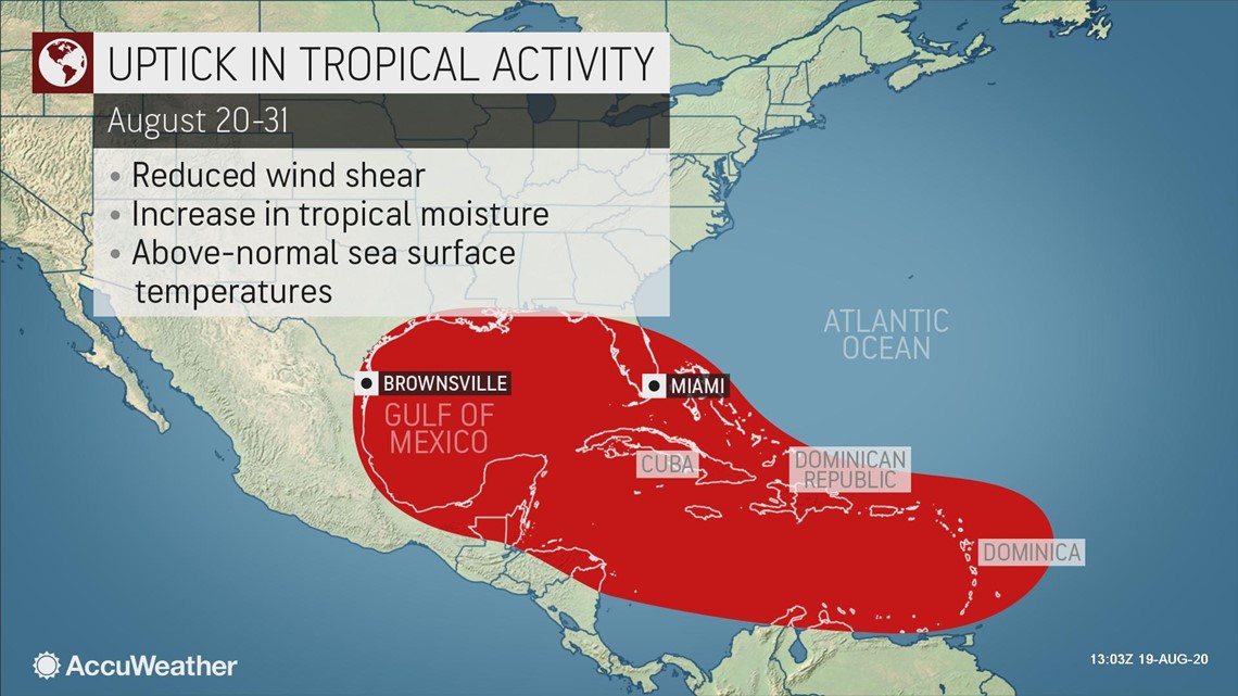
An environment favorable for tropical development often includes warm waters and weak wind shear, or the change of wind direction as you go up in the atmosphere, both of which are expected to be present in the western Caribbean Sea and Gulf of Honduras through the end of the week.

As the system continues westward and approaches Central America, it is likely to strengthen into a tropical storm by late this week.
The next names on the list for tropical storms for the basin in 2020 are Laura and Marco, which may both emerge in the Atlantic basin by this weekend as another tropical threat is churning east of the Leeward Islands.
No matter how strong the Caribbean system becomes, tropical moisture is forecast to stream into northern parts of Central America and the Yucatan Peninsula of Mexico.
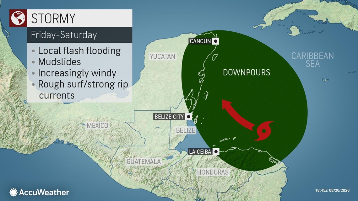
As the system approaches, the tropical moisture that accompanies it will enhance showers and thunderstorms across parts of Nicaragua, Honduras, Guatemala, Belize and southeastern Mexico. In these areas, rounds of downpours could quickly bring as much as 100-200 mm (2-4 inches) of rainfall in just a few hours, and with that will bring the risk for flash flooding.
The heaviest downpours are expected across northern Honduras through Belize and the eastern Yucatan into the weekend.

The mountainous portions of the region will be particularly susceptible to some of the highest rainfall totals. With a lot of rain in just a bit of time, the ground will become saturated and unstable quite quickly, leading to the risk for mudslides.
Damaging winds are also expected if the system attains tropical-storm strength. Exposed windward locations like coastal areas around and north of the center of the storm will be mostly likely to be impacted by destructive onshore winds. Should the storm remain stronger, these areas could also experience coastal flooding.
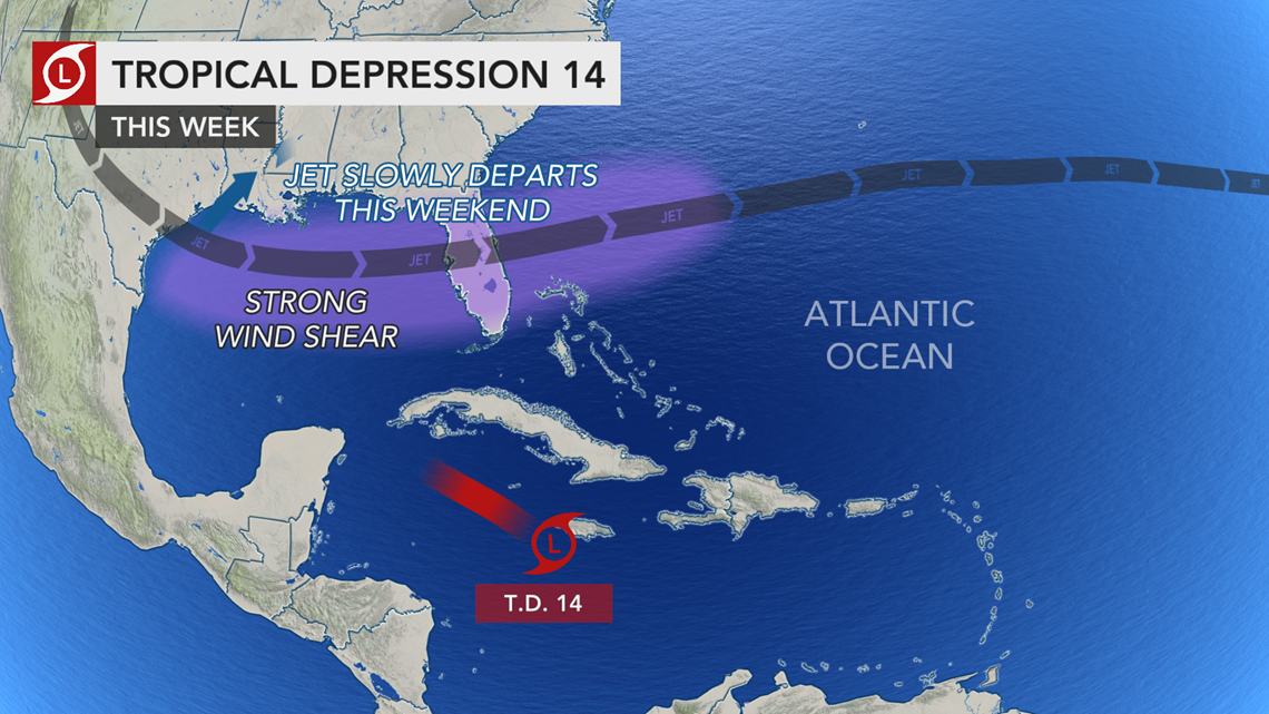
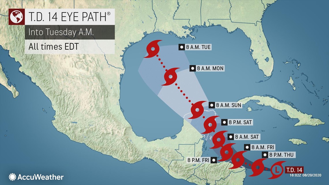
The complexity of the weather pattern over North America and the Gulf of Mexico means the final track of this tropical system late on Friday through the weekend is still somewhat uncertain.

A dip in the jet stream that is forecast to extend into the Gulf of Mexico may help steer the system Friday and through the weekend.
If the jet stream pulls this tropical feature northward enough, its torrential downpours and gusty thunderstorms could be pulled through Belize the Yucatan Peninsula before re-emerging over water in the Gulf of Mexico. This trajectory could even bring the tropical system toward northeastern Mexico and the western Gulf Coast of the U.S.
If the storm strengthens more quickly, and the dip in the jet stream is not as extreme, the tropical system may just continue to move westward and dissipate over the mountainous terrain or reach the waters of the East Pacific Ocean.
As a result, all interests from Honduras, Belize, Mexico and the southern U.S. should monitor tropical activity currently over the Atlantic basin.
In addition to this tropical system, Tropical Depression 13, spinning east of the Leeward Islands, is churning through another favorable location conducive for the depression to strengthen that could threaten the northern Caribbean and southern U.S. into next week.
"The lid could soon come off the Atlantic basin with the potential for multiple named systems spinning at the same time, including multiple threats to lives and property at the same time from the Caribbean to North America," said AccuWeather Senior Meteorologist Alex Sosnowski.

Due to 2020's record pace and upcoming conditions expected in the basin, AccuWeather meteorologists upped their forecast for the number of tropical storms in late July, with up to 24 now predicted and up to 11 hurricanes projected for the season.