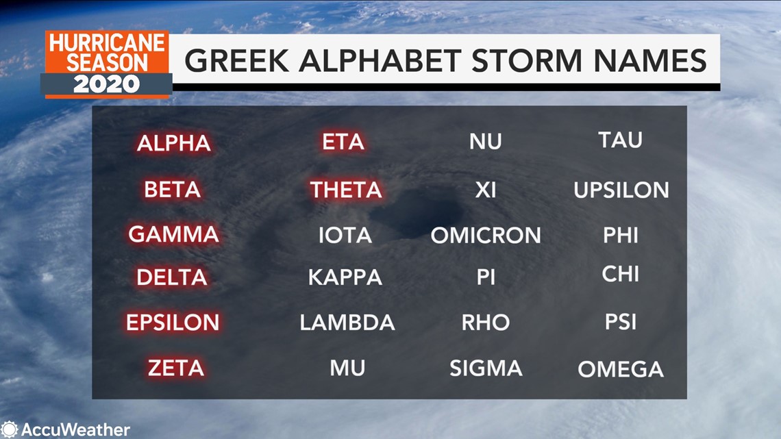
The formation of Subtropical Storm Theta on Monday night pushed the 2020 Atlantic hurricane season into uncharted waters, with no other season in history having produced so many named storms.
2020 has now churned out 29 named storms, breaking the single-season record of 28 storms from the infamous 2005 season, which produced powerhouse hurricanes such as Katrina, Wilma and Rita.
Theta's formation also marked another impressive feat -- the latest in the calendar year that two storms were swirling simultaneously in the Atlantic basin since Nov. 10, 1932, according to Philip Klotzbach, a meteorologist at Colorado State University. Eta continued to churn in the Gulf of Mexico following its landfall in Florida as Theta became classified as a subtropical storm on Monday night.
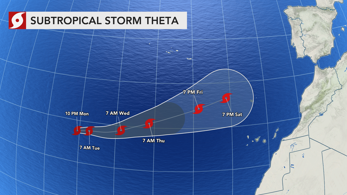
As of 3 p.m. GMT Tuesday, the storm was producing maximum sustained winds of 70 mph and was about 860 miles southwest of the Azores. Winds in the core of Theta were only a few miles shy of hurricane status, which is 74 mph or greater. The storm was moving to the east at 15 mph.
The storm is forecast to become fully tropical over the next few days and could become a hurricane as it becomes separated from a non-tropical system in the upper levels of the atmosphere.
"Theta will be over relatively warm water and should become fully tropical and perhaps a hurricane Tuesday as it develops a more coherent warm core circulation center," according to AccuWeather's top hurricane expert Dan Kottlowski.


"Theta will then start to move over cooler water during the middle and latter part of this week, which will not only limit just how strong the storm can get and will eventually lead to substantial weakening by the end of the week," Kottlowski said.
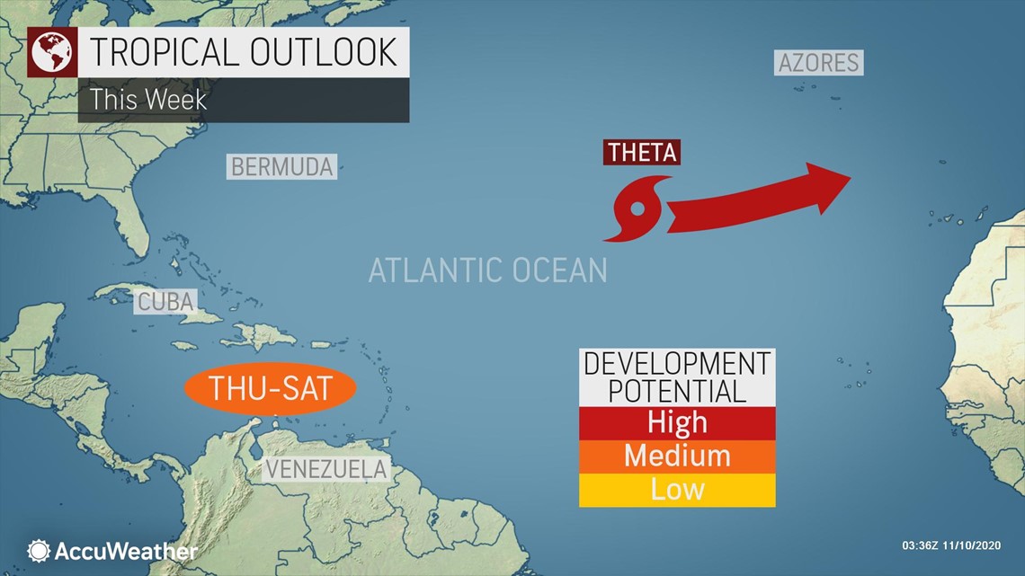
Late in the week and into the weekend, forecasters expect Theta to be drawn northward by a non-tropical system in the North Atlantic and eventually be absorbed by this system well west of the Iberian Peninsula.
"Theta is expected to pass in between the Azores and Canary Islands, with minimal impacts other than some increased surf. Theta may pass close enough to the Portuguese island of Madeira this weekend to bring some gusty winds and increased downpours, along with rough surf," AccuWeather Meteorologists Jake Sojda said.
Shipping interests in the region should closely monitor the path of Theta due to the dangers of rough surf.
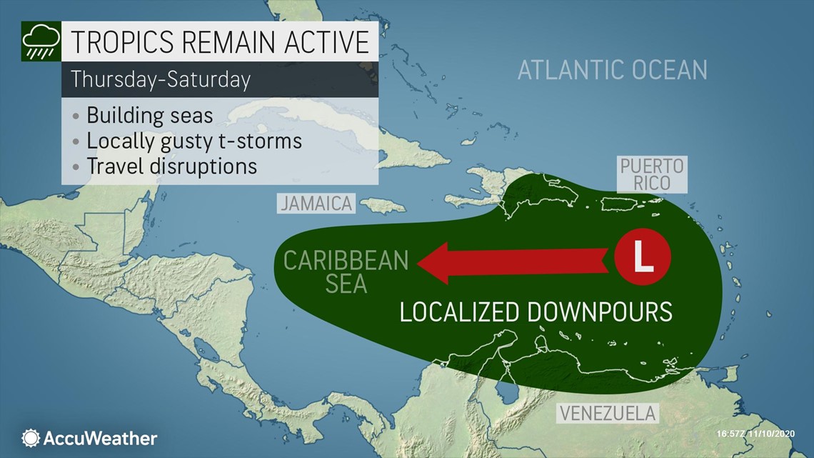
Elsewhere in the Atlantic basin, AccuWeather meteorologists are keeping a close eye on the central Caribbean Sea for additional tropical development.


"An east- to west-moving tropical disturbance will move into an area of low wind shear and warm water in the Caribbean this week," AccuWeather Senior Meteorologist Matt Rinde said.
These two environmental factors are conducive for tropical development and then strengthening.
The next system to reach tropical storm strength (maximum sustained winds of 39-73 mph) in the Atlantic basin would be given the name Iota.


Depending on the forward speed and strength of the feature in the Caribbean, there is the potential for building seas and surf and areas of heavy rain to spread westward along parts of the shoreline of the central and western Caribbean.


"Interests in Central America should closely monitor the situation as there is a chance of more torrential rainfall that may renew flooding toward the middle of November," according to AccuWeather Senior Meteorologist Alex Sosnowski.
"The first downpours from the system could reach part of Central America later this weekend and rainfall may ramp up significantly during the first part of next week," Sosnowski said.
Hurricane season doesn't officially end until Nov. 30.

