A storm system that began to spread snow and ice across the Midwest on Tuesday was not only marking the end to a record-setting warm spell across the region, but it was also threatening to cause dangerous travel conditions and even localized power outages into early Wednesday.
The dose of wintry weather and accumulating snowfall is following unusual warmth, adding to the shock value in the Midwest. Numerous locations approached, tied or exceeded record highs dating back more than 100 years over the weekend - and the eastern U.S. will feel one more warm day before weather changes arrive.
In the New York City area, nearly four dozen record highs were set on Sunday alone.
On Sunday, with a high of 76 F, Chicago had its eighth warmest November day on record.
The warm weather pattern has already come to an abrupt end in some locations of the Central states.
Cold air pushed across much of the Dakotas, western and central Nebraska and western Kansas as of Monday morning and will continue to advance eastward through the middle of the week over the Mississippi and Ohio valleys and Great Lakes region.
As a storm moves northeastward along the leading edge of the colder air, the transition in the Midwest is likely to be first marked by gusty winds and areas of drenching rain into Wednesday. The gusty winds may not only blow fallen leaves across streets and secondary roads but can cause difficult handling for motorists driving high-profile vehicles.
Near the leading edge of the cold air, thunderstorms can occur with the potential for isolated severe weather in the form of damaging wind gusts and small hail. The risk of locally severe storms and perhaps a couple of isolated tornadoes will extend from central Missouri, northeastward to northern Illinois and southern Wisconsin into Tuesday evening.
Chicago, Milwaukee, Detroit, Indianapolis, Cincinnati and Louisville, Kentucky, have all set or tied record highs on Tuesday ahead of colder air that will sweep in and send temperatures downward toward average levels. Typical highs during the second week of November range from the middle 40s over the northern tier of the Midwest to near 60 along the Ohio River.
"While places like the Twin Cities have already picked up over 9 inches of snow this season, temperatures at times have been running 15 to 30 degrees above average since Election Day," said AccuWeather Meteorologist Matt Benz.
"This sudden return to winter will certainly be a shock to the system after such a warm start to the month," Benz added.
Temperatures hit 73 F at Minneapolis-Saint Paul International Airport on Nov. 7, topping the old daily record of 72 set more than a century ago in 1874.
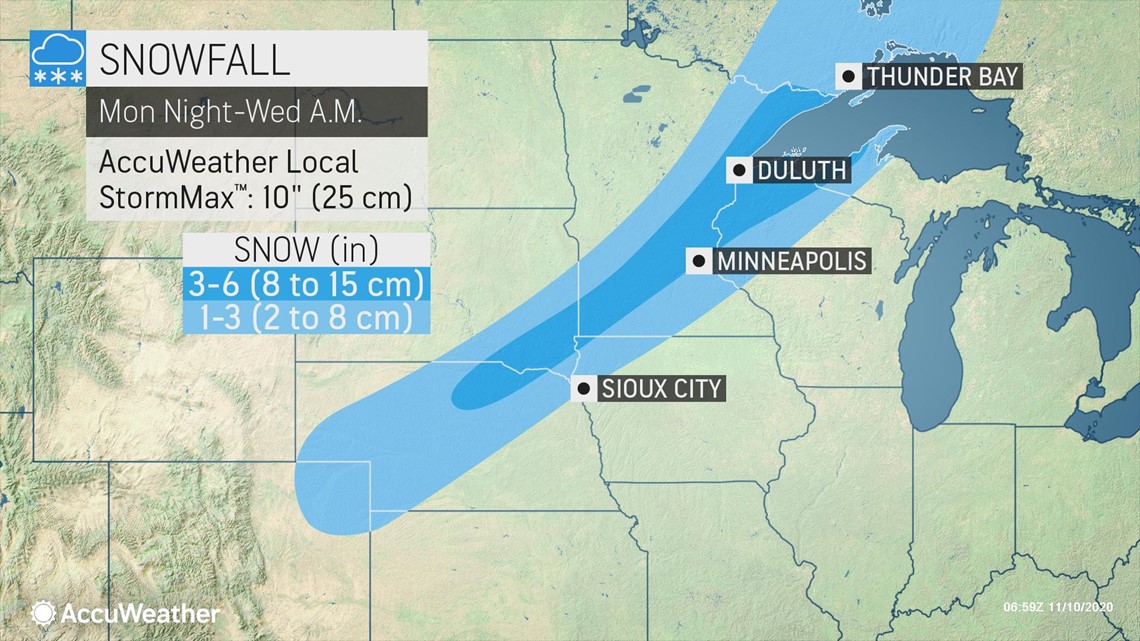
As the storm moves along the front, a band of snow that has already developed in the cold air over part of the Plains will become more intense for a period of time from northeastern Colorado to northeastern Minnesota and the western part of the Upper Peninsula of Michigan.

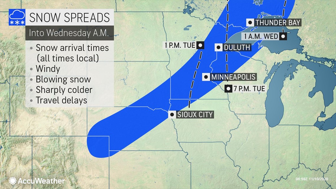
A general 1-3 inches of snow is forecast in this zone from Tuesday to Wednesday with a swath of moderate snow from northeastern Nebraska to the Arrowhead region of Minnesota. Within this swath, 3-6 inches of snow is forecast along with an AccuWeather Local StormMax™ of 10 inches.

A narrow swath of ice will occur near the boundary between the rain and snow. There can be up to 0.25 of an inch of ice that builds up on trees, power lines and bridges from part of northwestern Iowa to south-central Minnesota into Tuesday evening.
Despite the recent warmth, roads are forecast to become slushy, slippery and even snow-covered. Motorists should allow for extra time on their travels along interstates 29, 35, 90 and 94 in the region. Some of the cities, in addition to Minneapolis, where accumulating snow and travel delays are anticipated include Duluth, Minnesota; Sioux Falls, South Dakota; Grand Island, Nebraska; and Eau Claire, Wisconsin.

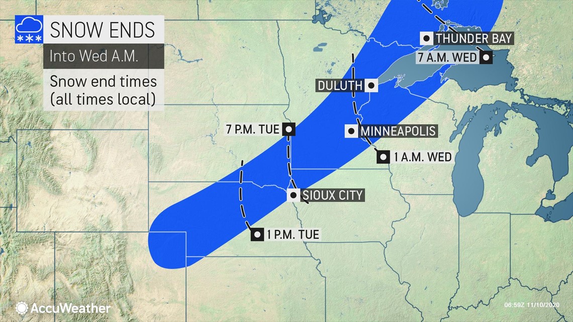
In-between the areas of snow and rain, a significant icing event can occur. Power outages will be possible across from part of southern Minnesota to northern Wisconsin due to the weight of the ice on tree limbs and power lines.
Snow and ice not forecast to advance very far to the east in this situation. In fact, the core of the coldest air will tend to hover over the northern Plains and be deflected northeastward into central Canada later this week. This means that a significant lake-effect event is not likely and lake-effect rain and snow may not occur at all this time around.
Still, cooler air will fight its way to the Appalachians during Wednesday night and Thursday, and eventually to the Atlantic coast from Thursday to Friday.

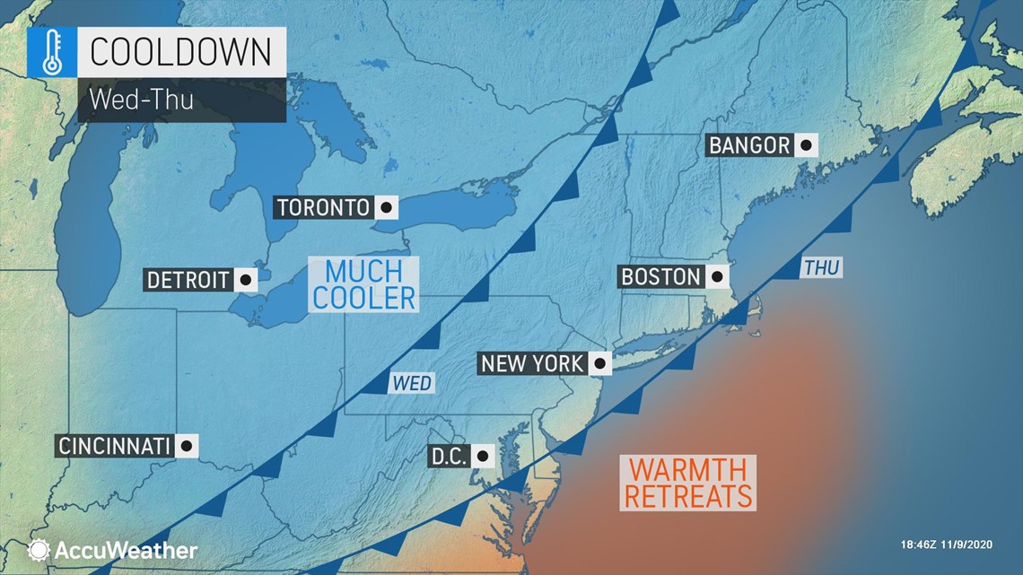
By Thursday, highs in the 50s will replace early-week highs in the 70s over the central Appalachians. By Friday, highs will be in the 50s from Boston to New York City and in the lower 60s in Washington, D.C., which will be close to the average for the middle of November.
Steady rain or at least a few showers will accompany the transition to cooler air in the East during the second half of this week. It is possible that a plume of tropical moisture tears away from Eta, over the Gulf of Mexico, and enhances rainfall along the Eastern Seaboard at the end of the week. This may make the difference between minor travel delays or more significant problems related to heavy rain and localized flooding.

