
After a handful of severe weather reports including hail and damaging winds on Thursday in portions of the Plains and Midwest, meteorologists say that the area affected by volatile weather is likely to expand in coverage and shift eastward on Friday.
Already early on Friday morning, a line of thunderstorms moved through northern Minnesota. This line produced hail ranging from the size of dimes to half dollars in northwestern Minnesota late on Thursday evening. In addition, a wind gust of 63 mph was also recorded. The line weakened some as it continued eastward, with very heavy rain becoming the primary threat.
A second area of thunderstorms moved across southwestern North Dakota late Thursday evening and into early Friday morning. Wind gusts of 60-70 mph were common with this cluster of storms.
In the wake of thunderstorms on Friday morning, the approach of a disturbance in the upper atmosphere and an area of low pressure will cause additional thunderstorms to develop into Friday night. Thunderstorm coverage is expected to increase farther southward as far south as Nebraska along a cold front.

"Thunderstorms will first gather steam across the far eastern Dakotas and Nebraska, then race eastward from there into Minnesota, Iowa and western Wisconsin during the Friday evening and overnight hours," said AccuWeather Meteorologist Renee Duff.
Even thunderstorms that are not strong or severe could put a damper on outdoor plans, including sporting events.
"The storms could spell trouble for the Minnesota Twins game at Target Field as they play the Kansas City Royals Friday evening," Duff added. "At the very least, a delay seems likely."
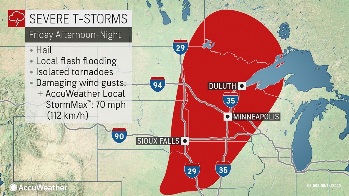
Besides Minneapolis where the Twins play, cities such as Duluth, Minnesota; Sioux Falls, South Dakota; Des Moines, Iowa; and Omaha, Nebraska, will all have the potential for severe weather. Unfortunately, this may hamper cleanup efforts that are still ongoing in some areas.
"This new round of storms can add insult to injury for property and land owners, as well as power crews, still cleaning up from recent rounds of severe storms, including the powerful derecho that swept through on Monday," said Duff.
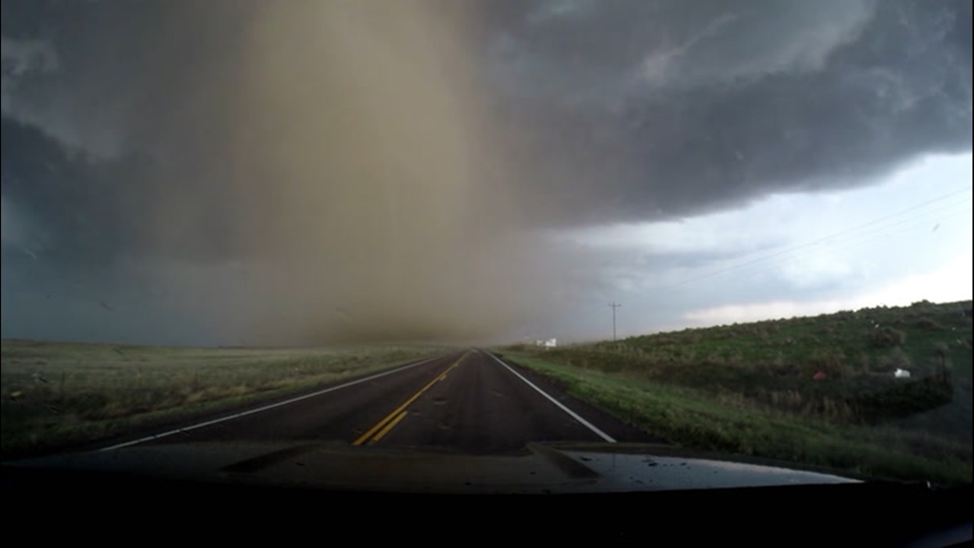
All hazards of severe weather will be possible, including flash flooding, hail and isolated tornadoes. Damaging winds are also expected, with an AccuWeather Local StormMax™ of 70 mph.
As the cold front weakens and the disturbance in the upper atmosphere lifts into Canada on Saturday, the threat for severe weather will be substantially lower. That said, a few severe storms could occur in the western and central Great Lakes.

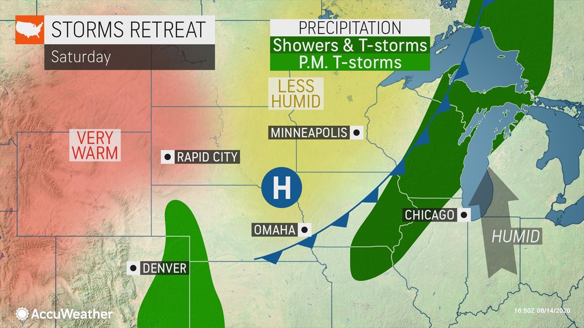
Thunderstorms could also produce strong winds in parts of Colorado, New Mexico and the Texas Panhandle on Saturday.
Heavy rain will be the main threat with thunderstorms in the Carolinas, although strong winds may accompany a few of the storms in that region as well.