

Excessive heat warnings and advisories were in effect up and down the East Coast, from Maine to South Carolina, on Monday, and forecasters say that sweltering 90-degree heat will prevail in part of the Northeast into the middle to latter part of this week despite the eruption of downpours on some days.
AccuWeather RealFeel® Temperatures were already climbing well into the 90s and nearing 100 F along the mid-Atlantic and Southeast coast by the midmorning hours on Monday.
Storms came calling Sunday night in part of the Northeast and more are in the offing in the coming days, but very little heat relief is anticipated.
"During Sunday night, a weak cool front slipped southeastward from the Great Lakes and is forecast to stall over the Ohio Valley, central Appalachians and mid-Atlantic coast," according to AccuWeather Lead Long-Range Meteorologist Paul Pastelok.

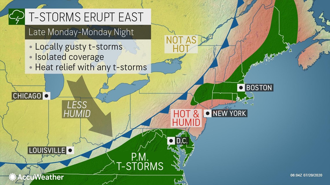
"Even though this front will be the ongoing focusing point of mainly afternoon and evening drenching and locally gusty thunderstorms through Tuesday, the overall weather pattern will remain hot over a large part of the Interstate 95 corridor Northeast for at least into the middle of the week," Pastelok explained.

Temperatures climbed well into the 90s during Monday afternoon with a few spots within a few degrees of 100 as of the middle of the day along the I-95 corridor from southern New England to the mid-Atlantic.
On Sunday, highs of 100 or higher were recorded at Baltimore/Washington International Airport, Maryland; Richmond and Norfolk, Virginia; and Harrisburg International Airport, Pennsylvania.
New York City is likely to stop short of its hottest day of the year so far. The highest temperature recorded at Central Park so far this season was 96 on July 6. Monday's high temperature well above 90 will make this an official heat wave for the Big Apple, as it will be the third consecutive day at or above 90 F.
Even parts of New England have ended up with an official heat wave in the pattern. Temperatures climbed to 90 F or higher for the third day in a row on Monday in Hartford, Connecticut; Providence, Rhode Island; and Boston to name a few cities.
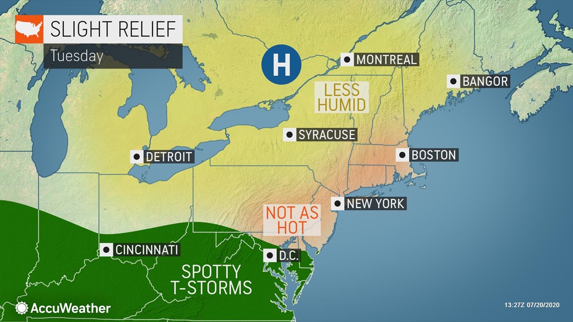
While temperatures are forecast to drop in New England, the eastern Great Lakes and in parts of the central Appalachians, it may take until the middle or end of the week before a more substantial dip in the temperature occurs in the I-95 corridor of the mid-Atlantic. And, even then, a refreshing dose of air with highs in the 60s and 70s is not in the offing for most of the region.
"The approach of a second front during the middle of the week with its clouds, showers and thunderstorms may keep high temperatures at a level close to or just above average," Pastelok said.
Highs during late July are generally well into the 80s in the mountains and within a few degrees of 90 in the Interstate-95 corridor of the mid-Atlantic.
How much of a temperature and humidity drop in the wake of that system may depend on how far south the jet stream dips and how much of an area is drenched by rain at roughly the same time. If only a slight jet stream dip occurs and rainfall ends up being sporadic, then daytime temperatures may still be quite high, even for July standards.
But, if the jet stream takes a big southward dip and is preceded by widespread showers and thunderstorms, it would allow cooler and less humid air to drain southward from eastern Canada.

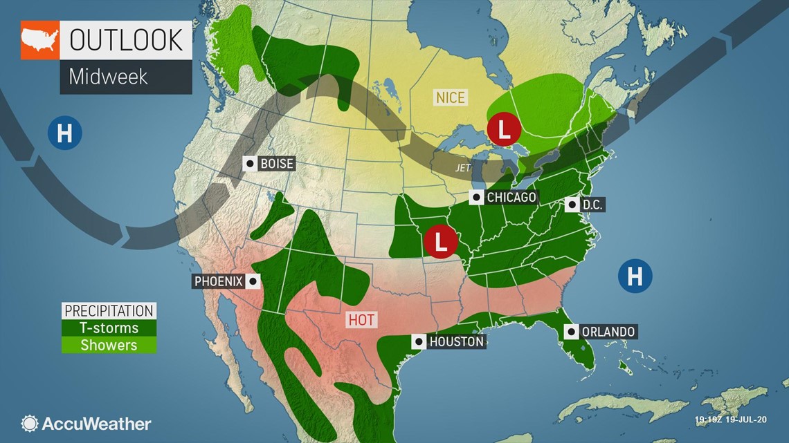
"Chances are it will be somewhere in between both scenarios for rainfall, temperature and humidity concerns for the middle and end of the week," Pastelok said.
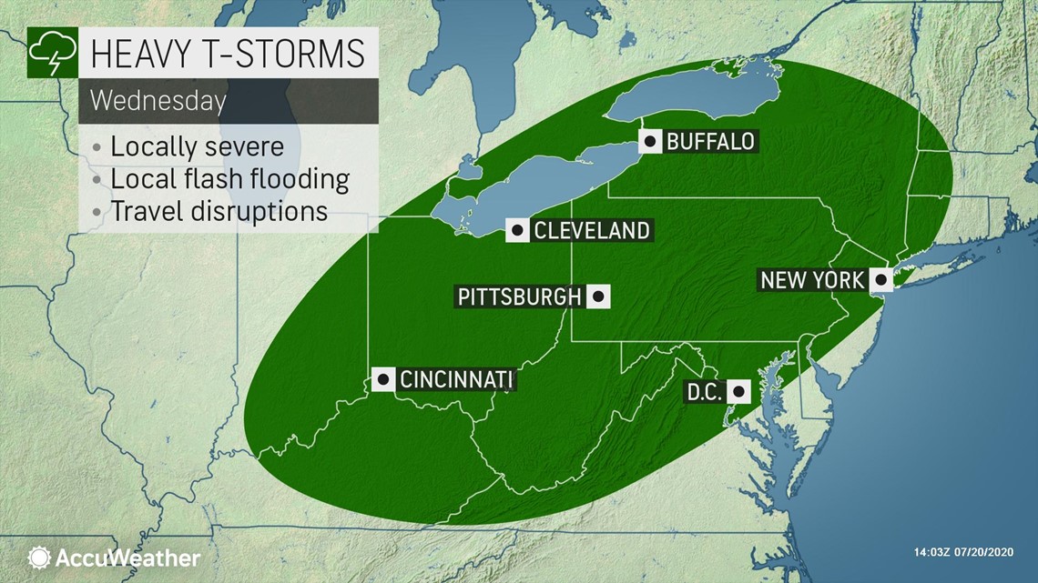
Motorists should anticipate travel delays from thunderstorms, especially in the swath from southern Ohio and West Virginia to Virginia, Maryland, Delaware and southern New Jersey during the afternoon and evening hours through Tuesday.
More showers and thunderstorms with disruptions to outdoor plans and travel are forecast for Wednesday to Thursday in the Northeast.

Rainfall that does not lead to flooding would generally be welcomed by lawn, garden and agricultural interests as rainfall has been less than average during a month when evaporation rates are the highest levels of the entire year. Lawns have turned brown in many communities and some established flower and vegetable plants have been withering in the afternoon heat and sunshine.
Some cities, such as Washington, D.C., may still have a high close to 90 on Friday, Saturday and Sunday, as New York City may experience a few days with highs in the middle 80s. Highs could top out close to 80 in the mountains of Pennsylvania and along the coast of northern New England.
"Some people in the central Appalachians, around the eastern Great Lakes and in central and northern New England may be able to turn off their air conditioners at night later this week and into this weekend," Pastelok said.
Nighttime temperatures may dip well down into the 60s over the interior Northeast late this week.
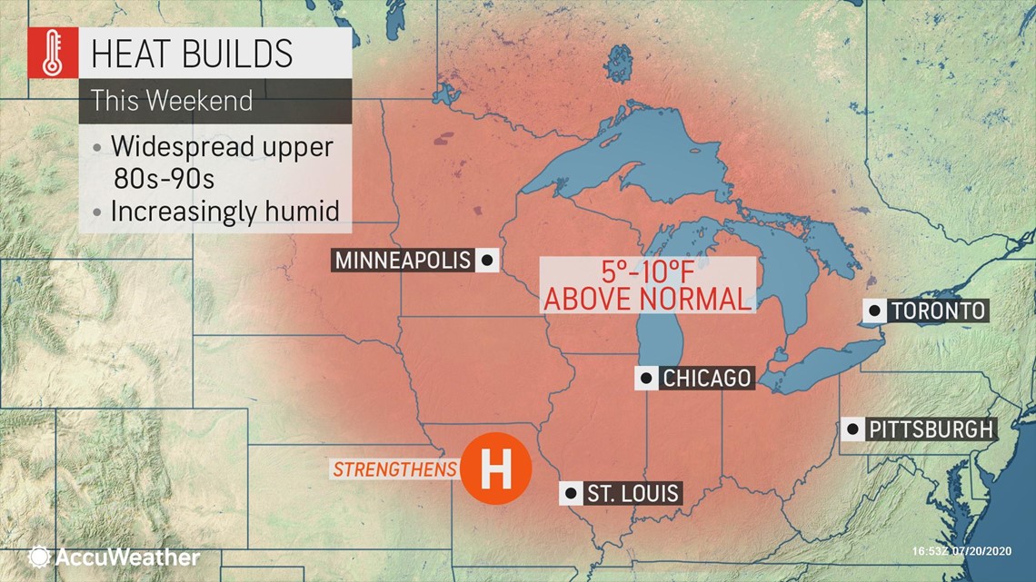
So while a break from extreme heat is on the way this week, people should not expect a big refreshing change. More heat may also try to surge back in from late this weekend to early next week. Heat will build once again over the Midwest during this weekend.

The National Weather Service's (NWS) Weather Prediction Center (WPC) tweeted that "heat is the leading cause of weather-related deaths in most years," adding that the central and eastern U.S. are facing dangerously hot conditions. The WPC urged people to seek air conditioning, avoid strenuous activities, wear light clothing, drink plenty of water and avoid leaving children and pets in closed vehicles as well as stressing the importance of recognizing the signs of heat exhaustion and heatstroke.
In the meantime, thunderstorms will be on the prowl in some locations each of the next three or four days, especially during the afternoon and evening hours. People should move indoors at the first rumble of thunder. If you can hear thunder you are at risk for being struck by lightning.