

A change in the weather pattern this week will not only bring an area of wet weather into the Northeast, but also usher cooler air into the region.
A dry pattern has remained stationary across much of the Northeast for the majority of September, and for some locations, much longer.
"Portions of Maine, New Hampshire, Massachusetts, Connecticut and Rhode Island are in an extreme drought, while much of New England to central Pennsylvania are in severe drought," said AccuWeather Meteorologist Ryan Adamson.
The storm bringing in the wet weather will originate in the center of the country. A huge dip in the jet stream will send that rain to the Eastern Seaboard as well as deliver a drastic cooldown in the Midwest.

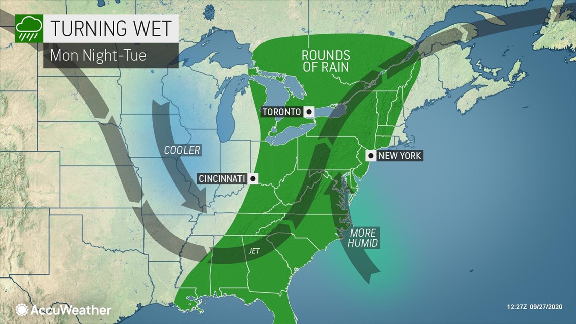
With the jet stream diving so far south, this storm will be able to tap into some tropical moisture from the Gulf of Mexico and the Gulf Stream off the Atlantic Coast of the Southeast.
Rain will progress from west to east on Tuesday and into Tuesday night, with rain likely to continue across eastern New England again Wednesday and Wednesday night.
"Some of the heaviest rain may target places like Hartford, Connecticut, New York City and Philadelphia on Tuesday night, with another round possible late Wednesday," added Adamson.
Travel delays can be expected and outdoor plans may need indoor alternatives through the middle of the week.
Any wind that accompanies the wet weather could also lead to additional early leaf drop, affecting the foliage later this fall.
Several rounds of rain could be beneficial to the region, helping ease some of the drought distress. But with these two rounds of heavier rain being so close together, flooding could also become a concern.
However, flooding will be most predominant in areas that have received excessive rain over the last several months, like Washington, D.C.; Richmond, Virginia; and Raleigh and Charlotte, North Carolina.

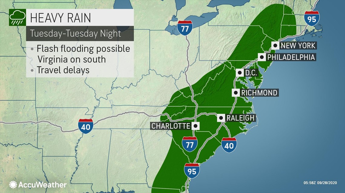
Across the mid-Atlantic and central Appalachians, some rivers are just now starting to recede following the heavy, tropical rainfall from Beta. Additional rainfall could cause water levels to rise in some smaller creeks and rivers in the region.
As the wet weather pulls northward into Canada, a new air mass will move into the Northeast in its place. This air mass will not only bring the return of drier conditions, but cooler air as well.
"As the calendar turns to October on Thursday, locations like the Adirondacks of Upstate New York as well as some high ground in northwestern Pennsylvania and the Laurel Highlands may not make it out of the 50s F," Adamson said.
By Friday, afternoon high temperatures in the 50s will be even more widespread across the interior Northeast, while places east of the Appalachians remain in the 60s.
Although a drastic change from the warmth early this week, temperatures of this degree are right around normal or a few degrees lower than normal for this time of year.

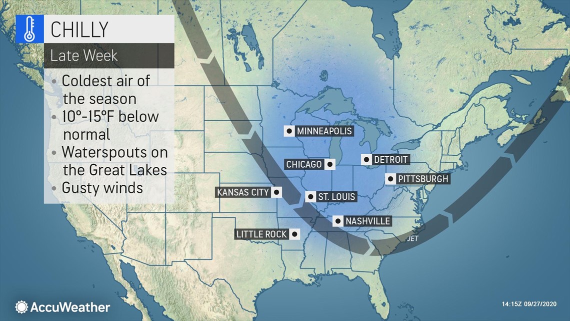
"The core of the coldest air will remain in the Midwest late this week, but temperatures only in the 60s are forecast to extend as far south as Raleigh and Atlanta," added Adamson.
Chilly air and mostly dry conditions are likely to stick around in the Northeast into next weekend.