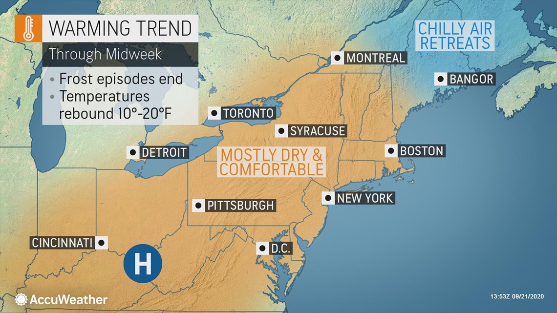
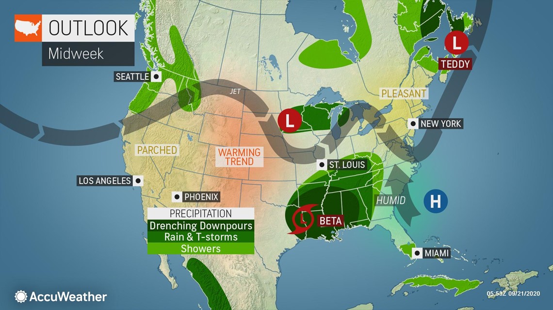
Following a string of cool days and cold, even frosty nights in some locations of the East, a significant warming trend is forecast this week. Temperatures are expected to climb back to or above average for the latter part of September.
Many people were wearing long sleeves and jackets to deal with the chilly mornings in the Northeast and embracing the cooler, drier air in the South this weekend. The conditions were more typical of the middle of October, rather than the middle to latter part of September. And, with the lack of smoke from wildfires in the western United States, the blue sky made the switch to October-like conditions even more dramatic.
Many locations across the central Appalachians and northwestern New England had frosts and freezes on multiple nights.
Saranac Lake, New York, dipped into the lower to middle 20s each morning from Friday through Monday and broke or tied record lows each morning, with the exception of Sunday morning. Freezing fog accompanied the cold air on Sunday and Monday morning.
Other locations that set or tied record lows from as far back as the 1950s spanning late last week to early this week include Rochester and Elmira, New York; Washington Dulles Airport, D.C.; Martinsburg, West Virginia; Millville, New Jersey; Youngstown, Ohio; Staunton, Virginia; and Allentown and Reading, Pennsylvania.
The October-like air dipped into the Southern states as well with lows in the 50s over portions of the Interstate-20 corridor, including the Atlanta area, this weekend. Temperatures dipped into the 40s for the first time since the second week in May in Charlotte, North Carolina, on Sunday morning.
However, the cool air that originated in northern Canada will continue to modify, and temperatures will trend back to average levels and then some during the middle to latter part of this week.


There are still a number of days where shorts and short-sleeved shirts can be worn in the Northeast. Warm and humid air will slowly build in the South later this week, too. In areas where there was widespread frost, the allergy season may have come to an end or taken a big hit, much to the delight of seasonal sufferers.
"Most areas in the Eastern states should experience temperatures rebounding by an average of 15 degrees from the early to the latter part of this week," according to AccuWeather Senior Meteorologist Brett Anderson.
Average high temperatures typically range from the middle 60s in northern Maine to the middle 80s in southern Georgia this week with average lows from the middle 40s in northern New England to the middle 60s just north of the I-10 corridor.
The most dramatic turnaround in temperatures will be in the Northeast states.
"In the northern states, the rebound may be 20 to 30 degrees in some cases from the respective daytime and nighttime conditions," Anderson said.


By the second half of this week, temperatures should be back to average levels in most areas and can even be several degrees above average in portions of the central Appalachians, the mid-Atlantic, New England and the Great Lakes region.
Highs will generally be in the 70s across the northern tier and within a few degrees of 80 in the South. Clouds and moisture from the Gulf of Mexico and to some extent from Tropical Storm Beta will hold high temperatures back later this week in the South but will cause nighttimes lows to trend upward significantly, along with higher humidity levels.


Backyard gardeners and agricultural interests in the Northeast will get a break from having to cover annual flowers and taking preventative frost measures on a mass scale starting by midweek. In most cases, except for northern New England, Tuesday morning should be the last frosty morning until sometime in October.
In portions of the Northeast, dry weather may continue through the end of this week and into this weekend in some cases. This will allow outdoor construction, painting and other maintenance projects to continue with little trouble from Mother Nature.

