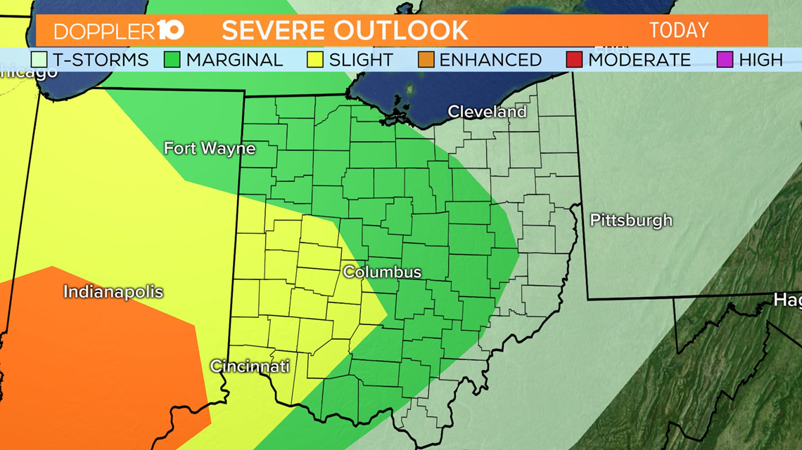
The Spring Equinox is officially at 11:39 p.m. tonight, with some very spring-like weather in store for the next couple days. Not only spring showers, but some severe weather will be possible across the state. Here's the latest severe weather outlook from the SPC (Storm Prediction Center).


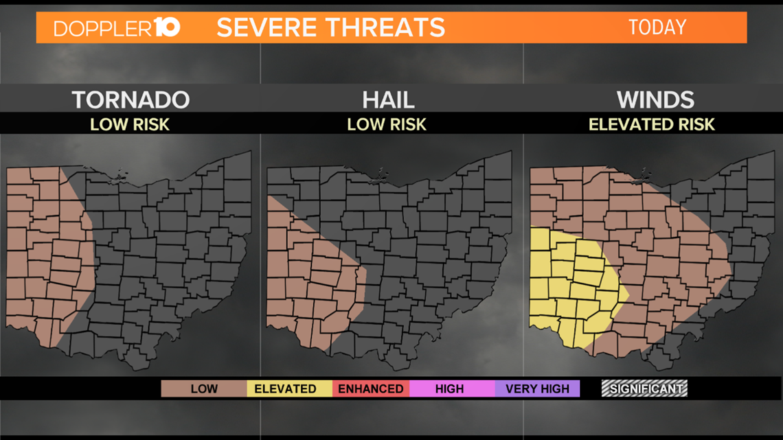
Most of central Ohio is included in the Marginal Risk for severe weather with parts of west-central Ohio upgraded to an enhanced risk. Basically, these strong storms will become more scattered from Indiana to western Ohio and will become more spotty through the rest of the state as they travel west to east. Here are the primary risks.


Out of these 3 risks, severe winds are the primary concern. Winds could gust in excess of 58 mph, so make sure you don't have any loose-lying objects outside the house. And while the risk is very low, we cannot rule out the potential for severe hail(1" in diameter or larger) or a couple tornadoes. The tornado threat(Far left image) is west of Columbus, in western Ohio, which includes parts of Union, Madison, Fayette, Champaign, Logan, Clark, Hardin, Hancock and western Wyandot & Marion counties.
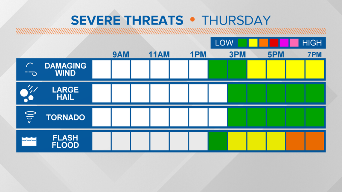
Another important risk is heavy rain, which could lead to flooding and flash flooding in spots. Here's a look at a rough hour-by-hour breakdown of these risks & when they could occur today.


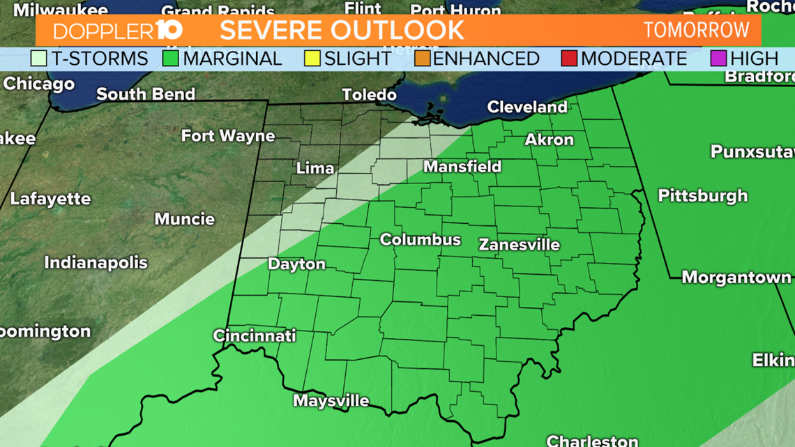
The window we're watching for severe weather is late this afternoon(3pm) to the late evening hours(9pm). During this time, showers and storms, some of which can be severe, will move through the state. Again, the risk for severe hail and tornadoes are low, but they will be possible within this timeline. Showers and storms will taper off after 9 p.m. with spotty showers through the night. Another round of showers and storms come through tomorrow, with a batch in the morning and early afternoon. There is a marginal risk for severe weather tomorrow as these storms move through.


Here's an animation of the storms moving through today & tomorrow.
Here's a look at today's hour-by-hour forecast. Stronger storms will be possible this afternoon & evening. The primary...
Posted by Ross Caruso TV on Thursday, March 19, 2020
Now is a good time to go over your severe weather safety plan & emergency kit with your family & make sure everyone is on the same page. Stay tuned for more details.


