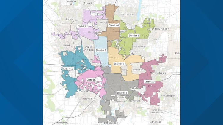
COLUMBUS, Ohio — The Council Residential Districting Commission (CRDC) released its first draft of a district map for Columbus on Wednesday.
The committee held multiple public meetings and gathered thousands of results that led to the creation of the map.
Due to the delayed results of the 2020 Census data, the commission used 2010 data to map out this first draft.
Future maps will be based on 2020 Census data which the committee says will be available in the next few weeks.
Commission member Monica Cerrezuela says, "These initial comments from the public will be instrumental in helping us create additional maps as we dive into the 2020 Census data and how we account for Columbus' 15% increase in population over the last decade.”
"We are so excited to share our work with the public," said Commission Chair Malik Moore. "I am grateful to have done a small part of the work with an amazing team of people. I will feel blessed to witness the work we started continue to grow and I believe one day we will see every voice lifted up. In a City as diverse as Columbus, the sky's the limit."
Columbus voters in 2018 voted to add two additional seats to City Council. The CRDC was created to help map out the changes needed for the nine districts.
The commission will send three maps to Council and Council will vote on one map by the end of the year. The district map goes into effect for the 2023 Council election.


